Route Editor

| Guide | ♦ | 1 Triplog | 0 Topics |
details | drive | no permit | forecast | route |
stats |
photos | triplog | topics | location |
| 31 | 1 | 0 |
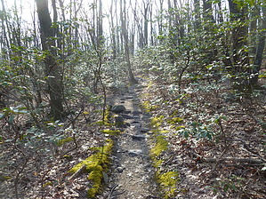
No cramps at Crampton Gap by kingsnake  The hike starts at Cramptons Gap, 15 miles southeast of Hagerstown. Besides the battle markers, Crampton Gap also contains the Townsend Monument, a stone arch dedicated to Civil War correspondents and artists, of both sides. (Perhaps the first monument to war journalists in history.) As on other segments of the AT I have hiked, each end of a segment contains a parking lot with plenty of spaces, a place to camp, and bathroom facilities.
There's a lot of neat rock formations along this AT segment. At 3.5 miles, near the end of the second 400-foot climb, there is a small outcropping with a clear view south along South Mountain, past Harpers Ferry and into Virginia. A few hundred yards past the outcropping, look back to your left, and you will see a faint trail that will take you to the commo towers at the top of Lamb Knoll. The towers are in two adjacent compounds, both fenced and heavily festooned with cameras. There are "US Government - No Trespassing" signs, but no sign prohibiting photograpy. (Which would likely be a federal crime.) After taking a few nervous looks at the commo towers, return down the faint path to the AT, then continue east for a few hundred yards before turning north. You are about halfway. A mile later you will cross the paved commo tower access road. If you continue straight across, you will be off the AT. Instead, turn slightly right after crossing. As on other Maryland AT segments, the AT is marked by a single white vertical mark, usually on a tree; one or two blue marks, or a ribbon indicates a side trail. After seven miles, you will arrive at Fox Gap. After spending some more time with the historical markers, continue north for the final mile to end of the hike at Turners Gap, where there are yet more historical markers. Note: At least in Maryland, the AT is very popular with trail runners and backpackers (especially of the Cub/Boy Scout variety). Check out the Official Route and Triplog. Leave No Trace and +Add a Triplog after your hike to support this local community. | |||||||||||||||||||||||||||||||||||||||||||||||||||||||||||||||||||||||||||||||||||||||||||||||