| Guide | ♦ | 5 Triplogs | 0 Topics |
details | drive | no permit | forecast | route |
stats |
photos | triplogs | topics | location |
| 15 | 5 | 0 |
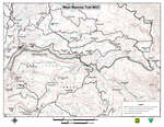
Starting elevation: 8,900 ft. (Transfer Recreation Area) Ending elevation: 10,900 ft. (Sharkstooth Trailhead) Trail length one way: 10 miles Maps: See Transfer Recreation Area (link above), SJNF map, USGS 7½' maps: Rampart Hills, La Plata Difficulty: moderate Next to the Big Al Trailhead is the West Mancos and Transfer Trailhead. These trails share one trail for the first ½ mile. The trail immediately drops down into the West Mancos River Canyon via several switchbacks. After about ½ mile the trail splits, with the West Mancos continuing up river, and the Transfer trail heading down river. Due to the steep nature of the upper portion of this trail, it can be very tricky in wet conditions and, if using this trail in early spring, be aware of downed trees and the trail sloughing off in places. Be especially careful if you are on horseback. The West Mancos Trail continues upstream on the west side of the canyon before dropping to the West Mancos River level, then climbs steeply to Horsefly Flat, an open, grassy area. The trail ends at the Sharkstooth Trailhead, at the base of Hesperus Peak. Check out the Official Route and Triplogs. Leave No Trace and +Add a Triplog after your hike to support this local community. One-Way Notice This hike is listed as One-Way. When hiking several trails on a single "hike", log it with a generic name that describes the hike. Then link the trails traveled, check out the example. | |||||||||||||||||||||||||||||||||||||||||||||||||||||||||||||||||
 Route Editor


