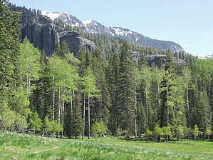
This trail ascends 3,400 feet from the trailhead to the Continental Divide. A couple of stream crossings may be difficult during high water, and three moderately steep sections are along the way. At mile 2.5, the Indian Creek Trail #588 goes east along Indian Creek to Palisade Meadows and the Continental Divide. At mile 7.5, the Williams Lake Trail #664 climbs to Williams Lake and the Continental Divide.
When hiking several trails on a single "hike", log it with a generic name that describes the hike. Then link the trails traveled, check out the example.
WARNING! Hiking and outdoor related sports can be dangerous. Be responsible and prepare for the trip. Study the area you are entering and plan accordingly. Dress for the current and unexpected weather changes. Take plenty of water. Never go alone. Make an itinerary with your plan(s), route(s), destination(s) and expected return time. Give your itinerary to trusted family and/or friends.
Permit $$
no fees or permits reported
if incorrect tell us about it
Directions
Road
To hike
page created by joebartels on Jul 21 2013 10:07 pm
 Route Editor


