|
tap row or icons for details
|
| Distance One Way |
|
0 miles |
| Trailhead Elevation |
|
6,482 feet |
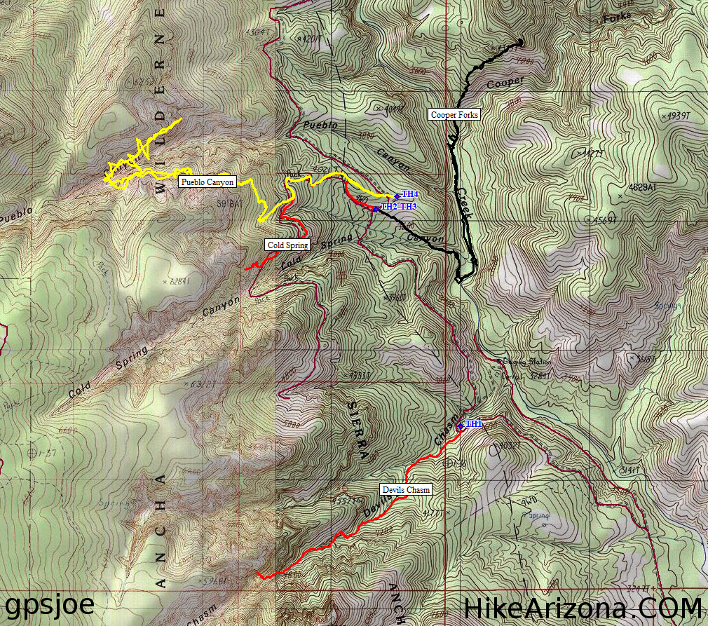
| Interest Off-Trail Hiking & Seasonal Creek | | unreported if dogs are allowed
editedit > ops > dogs to adjust |
| | |
|
|
20 |
2012-01-28 | The_Eagle |
|
|
14 |
2012-01-28 | johnlp |
|
|
9 |
2012-01-28 | sneakySASQUATCH |
|
|
14 |
2011-11-20 | Johnnie |
|
|
15 |
2010-09-21 | The_Eagle |
|
|
1 |
2010-09-21 | joebartels |
|
|
14 |
2010-09-21 | sneakySASQUATCH |
|
|
17 |
2010-08-31 | glutz |
| | Page 1, 2 |
| |
|
|
list |
map |
done |
Globe Region |
| | |
|
| |
|
|
Historical Weather |
| Trailhead Forecast | | |
|
 |
|
|
| Preferred May, Sep, Oct, Jun |
|
|
| | |
Named Locations Coordinate Links
| |
|
| Devil's Chasm - Upper
|
10.82 mi
3,558 ft |
|
|
| Devil's Chasm - Upper
|
12.28 mi
3,058 ft |
|
|
| Devil's Chasm - Upper
|
12.25 mi
3,456 ft |
|
|
| Devil's Chasm - Upper
| 2010-09-21 |
sneakySASQUATCH |
|
7.42 mi
3,084 ft |
|
|
| Devil's Chasm - Upper
|
7.83 mi
1,248 ft |
|
|
| Devils Chasm Boxed Narrows
|
4.48 mi
1,058 ft |
|
|
| | |
| |
|
|
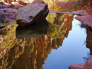
Overview: Into the abyss where few have roamed. Happy Trails!
 guide related
One-Way NoticeThis hike is listed as One-Way. When hiking several trails on a single "hike", log it with a generic name that describes the hike. Then link the trails traveled, check out the example. |
 Route Editor


