username
X
password
register
for free!
help
 

Cascades Canyon, NM

Guide 4 Triplogs  0 Topics
  3 of 5  
Fav
Wish
0
details
drive
no permit
forecast
map
stats
photos
triplogs
topics
location
45 4 0
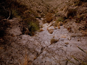
Canyons are inherently risky. Flash floods occur without notice on sunny days. Technical skills & surrounding topography knowledge required yet does not eliminate risk.
Statistics
tap row or icons for details
Difficulty 3.5 of 5
Route Finding 2 of 5
Distance One Way 1 mile
Trailhead Elevation 4,757 feet
Elevation Gain 1,300 feet
Accumulated Gain 1,340 feet
Avg Time One Way 1 hour
Kokopelli Seeds 5.47
 Interest Off-Trail Hiking, Seasonal Waterfall & Seasonal Creek
 Backpack No
feature photo
Photos Viewed All MineFollowing
24  2015-01-10
Alamo Gap
imike
45  2014-02-02 imike
Author
author avatar Guides 253
Routes 0
Photos 6,930
Trips 2,467 map ( 21,513 miles )
Age 75 Male Gender
Location Cloudcroft, NM
Historical Weather
Trailhead Forecast
Expand Map
Preferred Apr, Mar, Oct, Nov
Seasons   ALL
Sun  5:41am - 6:24pm
0 Route
 
0 Alternative


Private! Do Not Disturb!
by imike

Just north of the official Forest Service Trailhead for Alamo Canyon lies a number of interesting canyon cuts, all oriented such that the mouth of the canyons are on private land.


The first, PockRock Canyon, is easy to access; the landowners house is situated over next to Alamo Canyon Road.
remove free decal offer
RockaChucky Wash, the canyon further to the north, is hiked more commonly in its upper sections, above Prominent Point. The lower reaches are blocked by a number of substantial Dryfalls. The bottom of this canyon flows right through the landowner's backyard!

That is also the case for Cascades Canyon.

It is best to enter this cut by walking well to the east of the private residence, dropping over and down into the canyon without making the owner feel like you are invading their home.

This is a smaller drainage. It begins a touch on the dull side, but soon you will find yourself climbing the series of cascading bedrock dryfalls. As these get ever steeper you may decide to exit to a side ridge for easier ascending. In short order you will find yourself above the falls and on the mid level bench.

At this point you can continue to move on up to the upper cliffs and top out on the lower reaches of The Mesa... or... walk over to the north and check out the impressive Dryfalls in the lower reaches of RockaChucky Wash.

You may also head south to drop down into the lower reaches of PockRock Canyon... or move up the adjoining ridge to check out the odd intrusion formation on the north side of that canyon. This Pyramid shaped bit of sculpture houses a cave like detail along its lower edges.

Of the three canyons blocked off by private property, Cascades Canyon is the least appealing... but, still worth at least one visit!

2014-02-04 imike


    Check out the Triplogs.
    Leave No Trace and +Add a Triplog after your canyon trip to support this local community.
    WARNING! Hiking and outdoor related sports can be dangerous. Be responsible and prepare for the trip. Study the area you are entering and plan accordingly. Dress for the current and unexpected weather changes. Take plenty of water. Never go alone. Make an itinerary with your plan(s), route(s), destination(s) and expected return time. Give your itinerary to trusted family and/or friends.

     Permit $$
    None


     Directions
    or
     Road
    Connector trail - Not Applicable

    To canyon trip
    Hike over from the Trailhead for Alamo Canyon at the upper end of Alamo Canyon Road... off of the south end of Scenic Drive in Alamogordo, NM. You could also descend off The Mesa.

    Be very considerate of the private residences in the area. The mouth of the canyon is right in their backyard!
    page created by imike on Feb 04 2014 12:38 pm
     90+° 8am - 6pm kills
    helpcorrectionissue

    end of page marker