username
X
password
register
for free!
help
 

Hawes Trail #52 - Hawes, AZ

Guide 38 Triplogs  0 Topics
  2.9 of 5  
Fav
Wish
0
details
drive
no permit
forecast
route  
stats
photos
triplogs
topics
location
188 38 0
Statistics
tap row or icons for details
Distance One Way 3.75 miles
Trailhead Elevation 1,464 feet
Elevation Gain 764 feet
Accumulated Gain 946 feet
feature photo
Photos Viewed All MineFollowing
Will recalculate on button tap!
7  2025-06-22
Hawes Trail System
DarthStiller
10  2025-02-23
Twisted Sister - Hawes
DarthStiller
1  2025-01-04
Hawes Mostly-On Trail Loop
CannondaleKid
15  2024-02-27 kingsnake
7  2024-02-17
Boulderdash Trail - Hawes
DarthStiller
14  2023-12-24
Hawes Trail System
DarthStiller
10  2022-09-10
Hawes Trail System
DarthStiller
5  2022-04-10
Hawes Trail System
DarthStiller
Page 1,  2,  3,  4
Author
author avatar Guides 16,843
Routes 17,472
Photos 24
Trips 1 map ( 6 miles )
Age 28 Male Gender
Location HAZ, TrailDEX
Historical Weather
Trailhead Forecast
Radar Map
Expand Map
Preferred Jan, Dec, Feb, Mar
Sun  6:03am - 6:47pm
Official Route & 1 Rt
 
18 Alternative


remove free decal offer

Guide Needed
Publish Full Detail Guide


Use +Add above to share photos and triplogs
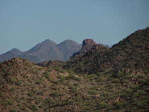
Namesake trail in the Hawes Trail System. Heavy mountain bike usage, also open to hiking and equestrian use.


    Check out the Official Route and Triplogs.
    Leave No Trace and +Add a Triplog after your mountain bike ride to support this local community.
    WARNING! Hiking and outdoor related sports can be dangerous. Be responsible and prepare for the trip. Study the area you are entering and plan accordingly. Dress for the current and unexpected weather changes. Take plenty of water. Never go alone. Make an itinerary with your plan(s), route(s), destination(s) and expected return time. Give your itinerary to trusted family and/or friends.

     Permit $$
    None


     Directions
    or
     Road
    Paved - Car Okay

    To mountain bike ride
    Pre 2018
    Exit Loop 202 / Red Mountain Freeway at Power Road. Travel north 2 miles and park in the dirt lot on the west side of the road just after crossing the canal. The trail begins just downhill from there on the east side of the road.

    2018
    There is NO LONGER ANY PARKING on the west side of Power Road/Bush Highway.
    The Central Arizona Project has added a new fence and gate with NO PARKING signs.
    While there will be some parking along Power south of the canal, a good option is parking either behind the Walgreen's at Power & Thomas or the Park & Ride on Power under the 202.
    page created by chumley on Feb 27 2014 11:30 pm
     90+° 8am - 6pm kills
    helpcorrectionissue

    end of page marker