username
X
password
register
for free!
help
 

Panther Gulch, AZ

Guide 2 Triplogs  0 Topics
  3.5 of 5  
Fav
Wish
0
details
drive
no permit
forecast
map
stats
photos
triplogs
topics
location
12 2 0
Canyons are inherently risky. Flash floods occur without notice on sunny days. Technical skills & surrounding topography knowledge required yet does not eliminate risk.
Statistics
tap row or icons for details
Distance One Way 0 miles
Trailhead Elevation 3,995 feet
 Interest Off-Trail Hiking & Seasonal Waterfall
unreported if dogs are allowed
editedit > ops > dogs to adjust
feature photo
Photos Viewed All MineFollowing
13  2022-11-29
Chubb Mountain
DixieFlyer
12  2008-12-21 ssk44
Author
author avatar Guides 16,843
Routes 17,472
Photos 24
Trips 1 map ( 6 miles )
Age 28 Male Gender
Location HAZ, TrailDEX
Historical Weather
Trailhead Forecast
Expand Map
Preferred Oct, Nov, Feb, Mar
Sun  6:02am - 6:42pm
1 Route
 
0 Alternative


remove free decal offer

Guide Needed
Publish Full Detail Guide


Use +Add above to share photos and triplogs
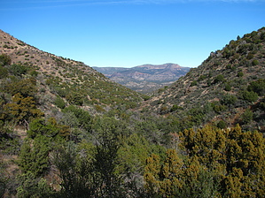
Overview: An old pack trail route up Panther Gulch. Panther Gulch is located in a remote area of the Sierra Ancha Mountains, East of Punkin Center off Highway 188.


  • guide related image
    guide related


Check out the Triplogs.
Leave No Trace and +Add a Triplog after your canyon trip to support this local community.
WARNING! Hiking and outdoor related sports can be dangerous. Be responsible and prepare for the trip. Study the area you are entering and plan accordingly. Dress for the current and unexpected weather changes. Take plenty of water. Never go alone. Make an itinerary with your plan(s), route(s), destination(s) and expected return time. Give your itinerary to trusted family and/or friends.

 Permit $$
None


 Directions
or
 Road
TBD

To canyon trip
From Mesa take Highway 87 towards Payson. Turn on Highway 188 and drive to Punkin Center. From there take FR71 to Greenback Valley/Conway Ranch. Do not enter the private property of Conway ranch! Before FR71 enters the ranch site, turn left on FR236A. Follow FR236A around the private property to an old small wooden corral that is on left side of the road and park. On the south side of the road from the corral you will see a broken gate that accesses a narrow sand drainage heading through the brush. This drainage will take you to an ATV trail that heads around the eastern boundary of the ranch through the Greenback Valley area. On the south side of the private property you will see Red Blanket Peak, which is start of Panther Gulch. Note all signs marking the property boundary. Do not go through any gates with "No Trespassing" signs. (Special Note) The Conway family is friendly and have zero issues with people traveling around the boundaries of there ranch as long no one enters the well marked back property gates and do not damage any personal property. Heeding this warning will ensure many years of privileged access to a large remote area.
page created by joebartels on Dec 21 2008 7:35 pm
 90+° 8am - 6pm kills
helpcorrectionissue

end of page marker