| Guide | ♦ | 26 Triplogs | 0 Topics |
details | drive | permit | forecast | route |
stats |
photos | triplogs | topics | location |
| 246 | 26 | 0 |
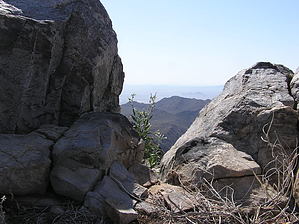
Southern Estrella Peak by AndrewAZ  Overview OverviewLike Hayes Peak (Estrella Peak 4512), Montezuma Peak is a rugged backcountry hike. There is no trail and no obvious reason to hike to the peak since it isn't the highest point in the Sierra Estrellas. Throw in difficult access, and most hikers probably give this one a pass. However, if solitude, desert scenery, and great views are your goal, this is an ideal hike. The hike is fairly short. It is roughly half a mile to the stone house and one and a quarter miles from the house to the peak. However, it gains 2,550 feet of elevation in that 1.8 miles. Be prepared for a leg workout.
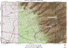
Approach On 2/25, I met up with two friends to give it a try. We left Tempe around 5:00 a.m. and approached the Estrellas using the I-10/Sierra Estrella Parkway/Elliot Road route. We reached the intersection of Riggs Road and Rainbow Valley Road around 6:00 a.m., and shortly thereafter entered the wilderness area using the Riggs Road alignment. It was obvious that it's been a dry winter: the usually sandy and loose road was packed hard and heavily washboarded. We passed Rainbow Rancho, which would be easy to miss if you weren't looking for it. When I first saw it in 2005, there were still several structures, a hangar, a mortar launcher, and signs of recent occupation. The mortar is gone now, the hangar has collapsed, and the other structures have been torn down (or burned down). In the early morning light, it looked like the set from a horror movie. We hit the T junction at the power lines, turned right, and continued south. We passed the turn-off for the Quartz Peak trailhead at 1.9 miles and found our turn-off 1.2 miles after that. We followed this road for about 2 miles and reached a wide area with several campfire rings. It looked like most people park at this point, but since we had a high-clearance vehicle with four-wheel drive, we kept going. The road rapidly deteriorates and becomes extremely steep and rocky. It ends a half mile past the wide area, so stopping at the wide-area doesn't add much distance to the hike. Hike We got started around 6:45 a.m. with temperatures around 60. We all had long-sleeve shirts on but took them off with the first quarter-mile of the hike. We were surprised to find a trail starting where the road ends. There is clearly a great deal of foot traffic on the trail, as it's extremely obvious and easy to follow. There are also cairns every 50 feet, so while some care must be taken to avoid rocks and cacti, getting lost at this point would take talent. After a half-mile of hiking, we reached the remains of the stone house at Don Joaquin's Lost Spanish Mine. We took a look at the house and the mine shaft and decided which route we wanted to take to the peak. We chose to continue up the wash, which would have the benefit of being in the shade all morning. At this point, the trail and cairns ended. From the stone house to the ridgeline just below the peak, hiking followed a consistent pattern: survey the terrain for the best route, hike 10-50 feet while choosing the best footing for each step, and then reassess the situation. There was plenty of brush, so many times the best route was the one that required the least fighting with cacti and catclaw. The biggest challenge while moving up the wash (aside from the catclaw) was the amount of slick rock. There are a dozen or so slick rock areas that must be surmounted. Some can be directly overcome by zigzagging up through them and using any rough spots as stairs, but others are too smooth and steep and have to be circumvented entirely by going far to the right or left. This is where good route-finding skills will pay off the most. Montezuma Peak was visible the entire time, so we followed the wash all the way to the ridgeline just north of the peak. We took frequent breaks to enjoy the scenery. Rainbow Valley was gorgeous in the early morning sun, and it remains amazing that such an empty and desolate place is so close to Phoenix. We saw a caravan of vehicles appear from the other side of Seven Mile Mountain (they must have approached from AZ-238 at Mobile), but we never saw them again, so perhaps they went to Quartz Peak or Hayes Peak. We reached the ridgeline with Montezuma Peak off to our right. We were finally in the sun, and shade would be scarce for the remainder of the day. We worked our way up the peak using an obvious ravine on the east side of the peak. It requires some scrambling and using one's hands, but nothing too tough or scary. The official summit has a USGS marker (4,337 feet) and a coffee can with a collection of notes inside. It was sunny and the temperature was perfect. The views were great in all directions or would've been if it hadn't been so hazy. Phoenix was visible, and South Mountain looked rather sad and small. It was possible to see Woolsey Peak, Big Horn Peak, and Table Top, but beyond that, most peaks were not easy to see due to the haze. Other than the tarantula hawks that were cruising around, we appeared to have the whole Estrella wilderness to ourselves. Or so we thought. After a moment, we heard a sustained screeching and noticed a peregrine falcon perched on some rocks about 20 feet away. It appeared to be less than thrilled with our presence and continued to screech at us for several minutes. It stopped, but it remained rooted in place and eyeing us balefully. We stayed on the peak for 20 minutes and it never moved from its position, so we assumed it was guarding a nest. We started back down the wash and mostly used the same route to head down that we did on the way up. The falcon followed us down the mountain, circling and occasionally landing to screech at us some more. We were in the sun for the trip down, so it was much warmer (close to 80 degrees) and not quite as much fun as the trip up. We stopped again at the stone house and mineshaft to take some pictures with better lighting and then continued back to the vehicle. On the way out, we noticed that the road split at the wide-area with the fire rings. We took the road to the left, which took us south. The road ran between the Estrellas and Seven Mile Mountain and there were plenty of tracks to indicate that the road sees lots of use. Whenever we reached a fork or split, we continued generally south on the road that looked like it had the most tracks. Shortly before the road broke free from the hills between the Estrellas and Seven Mile Mountain, we crossed a cattle guard and went through a barbed-wire fence. After that, the road became much sandier and a maze of splits and forks. We could see Maricopa in the distance and see the cattle feedlots along AZ-238, so we generally aimed in that direction. It took some wandering, but we hit AZ-238 at Rio Bravo Road, which is just a few miles outside Maricopa. We took AZ-347 back to the metro area and quickly reached Tempe. With a good map, taking the Rio Bravo route would probably cut 15-25 minutes off the drive to the trailhead from the east valley. Overall, it was a great day. The weather was ideal, the scenery was amazing, and the hike was strenuous enough to feel like we had accomplished something. It was a great hike and worth doing, but it probably won't be high on the list of hikes to repeat. It's a long drive for a short hike, and the views from Hayes Peak are generally better. Check out the Official Route and Triplogs. Note This is a moderately difficult hike. Leave No Trace and +Add a Triplog after your hike to support this local community. | ||||||||||||||||||||||||||||||||||||||||||||||||||||||||||||||||||||||||||||||||||||||
 Route Editor


