Route Editor

| Guide | ♦ | 11 Triplogs | 0 Topics |
details | drive | no permit | forecast | 🔥 route |
stats |
photos | triplogs | topics | location |
| 277 | 11 | 0 |
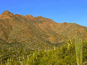
This ain't no lemon by John10s  Overview OverviewLime Peak (3,789') is located in Tonto National Forest, west of Horseshoe Reservoir. The summit includes a benchmark, with a nearby frustum marking the Maricopa/Yavapai county line. When the water level in Horseshoe Reservoir is low enough, a shorter route to Lime Peak is available by starting from the boat ramp on the reservoir's southwest side and crossing the lake's dry "arm". Triplogs contain detailed write-ups and GPS tracks for that option; the route described here allows you to bypass that part of the reservoir when water levels are higher. Long pants, gloves, and protective clothing are recommended for this hike, as a significant portion is off-trail and brushy. Hike The journey begins near the intersection of Horseshoe Dam Road and FR 1530. There are plenty of wide spots to park along the forest road near the intersection. The first few tenths of a mile of the road are in good condition and are passable for high clearance vehicles, so you can shorten the hike by driving farther down FR 1530 and parking when the road becomes too rutted or washed out.
The next destination is a little over a mile and a half to the north, at the base of a ridge leading up the east side of Lime Peak. This portion of the hike involves navigating around or through many shallow drainages while dodging typical desert vegetation, including plenty of saguaros and prickly pear. While there aren't any major obstacles along this stretch, the brush does get thicker as you move farther north, particularly around the drainages. In these areas, long pants and gloves come in handy. Approaching the base of the ridge, you'll start to gain elevation and encounter more loose, marble-size rocks on the slopes, which can make footing more challenging. Continue until you reach the ridge at roughly 34.003402, -111.749768. From here, turn left (west) to start the steep climb up to the peak, gaining 1,000+ feet over the next three-quarters of a mile. Route finding is easy as you follow the ridge up and over several small false summits. Though the grade is steep, there's no major exposure, and only minor scrambling is required in a few spots. Lime Peak finally comes into view above, and you'll eventually level off on the ridgeline just south of the peak. From there, it's a short, flat hike over to the LIME benchmark, placed in 1924, with several metal and wooden posts from an old height of light scattered nearby. The summit provides nice views of the Mazatzals to the east beyond Horseshoe Reservoir, including Sheep Mountain, Mazatzal Peak, Mt. Catherine, Mt. Peeley, and Saddle Mountain. On the distant southern horizon, you can see the Superstition Ridgeline and Weaver's Needle. To the southwest, Humboldt Mountain and the series of peaks to its south are visible, and Sunset Mountain and Peak 4413 are the major high points to the north. Before leaving the summit area, hike another ~500 north from the peak to visit the frustum, also placed in 1924, marks the Maricopa/Yavapai county line. If you want to extend the adventure, you can continue to Sunset Mountain ~1.5 miles away, otherwise you can return via the same route, descending the ridge and then working your way south along the east side of the mountain back to Lime Creek and FR 1530. Check out the Official Route and Triplogs. Leave No Trace and +Add a Triplog after your hike to support this local community. | ||||||||||||||||||||||||||||||||||||||||||||||||||||||||||||||||||||||||||||||||||||||||||||||||||||||||||||||||||||||||||||||||||||||||||||||||||||||||||||||||||||||||||||||||||||||||||||||||