 Route Editor

| Guide | ♦ | 10 Triplogs | 1 Topic |
details | drive | permit | forecast | route |
stats |
photos | triplogs | topic | location |
| 46 | 10 | 1 |
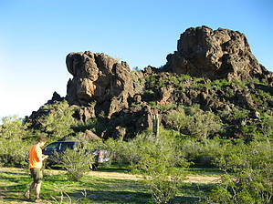
everybody does it by HAZ_Hikebot  Peak elevation 1931 feet. Stats are for the long explorer route from Dairy Queen. If you are hiking Newman the super short drive up approach might fit the bill. Otherwise it would be a waste of gas. Peak elevation 1931 feet. Stats are for the long explorer route from Dairy Queen. If you are hiking Newman the super short drive up approach might fit the bill. Otherwise it would be a waste of gas.Check out the Official Route and Triplogs. Leave No Trace and +Add a Triplog after your hike to support this local community. One-Way Notice This hike is listed as One-Way. When hiking several trails on a single "hike", log it with a generic name that describes the hike. Then link the trails traveled, check out the example. | ||||||||||||||||||||||||||||||||||||||||||||||||||||||||||||||||||||||||||||||||||||||||||||||||||||||||||||||||||||||||||||||||||||||||||||||||||||||||||||||||||||||||||||||||||


