Route Editor

| Guide | ♦ | 50 Triplogs | 0 Topics |
details | drive | no permit | forecast | route |
stats |
photos | triplogs | topics | location |
| 50 | 50 | 0 |
A Preserve that May Not be Preserved by azdesertfather  Tortolita Preserve is a 2,300-acre preserve managed by the town of Marana under a lease from the State Land Department since 2000. It is right at the end of Moore Road and sandwiched between Moore Road and The Gallery golf course. It is a nice old-growth, ironwood-saguaro forest, with mature, mistletoe-filled ironwoods from 300 to 1,000 years old and large, mature saguaros a couple of centuries old. Tortolita Preserve is a 2,300-acre preserve managed by the town of Marana under a lease from the State Land Department since 2000. It is right at the end of Moore Road and sandwiched between Moore Road and The Gallery golf course. It is a nice old-growth, ironwood-saguaro forest, with mature, mistletoe-filled ironwoods from 300 to 1,000 years old and large, mature saguaros a couple of centuries old.The preserve was originally set up as housing developments and more started cropping up in the area, further threatening the cactus ferruginous pygmy owl, which at the time was on the endangered list. In 2006 the pygmy owl was taken off the federal endangered list, however, and since then there have been talks of Marana backing out of their 99-year lease as the lease rates escalate, to use the money for other purposes. There is a distinct possibility, if Marana backs out on the lease, that one day the preserve will be gone and purchased up from the state by the Dove Mountain developments that back up to its northern and eastern boundaries. So enjoy it while you can!
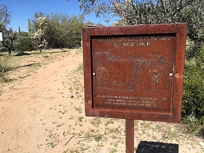
If you are looking for a fairly easy-to-follow trail or just looking for a place to get in a good, fairly flat trail jog, this is a good one to do. Dogs are ok in the preserve but must be leased at all times. The only real trail in the preserve is a loop trail that mostly follows the outer borders of the preserve. All along this loop, you will see metal signs designating particular features of interest, such as old ironwoods or specially named, notable saguaros, like Strong-Arm Saguaro, just under 5 miles into the loop. Once passing through the gate where the paved Moore Road ends, follow the dirt Moore Road about 150 yards and you will see an entrance to the preserve on the right. After coming upon a rusted, metal map sign, almost immediately once entering into the preserve, the trail splits to form the loop. Following the loop in a counterclockwise position, the hike will head north for about 1¼ miles alongside Wild Burro Road. Here the main trail turns east, though there is a smaller trail about ¼ mile long that continues north and cuts off the 3 miles of the loop in the far NE portion of the preserve. Taking the main route, the trail follows the boundary which is just north and west of homes adjacent to the preserve until you get to the preserve's far NE corner. Here, as the trail follows the northern boundary, which butts up against The Legacy golf course — fairly odd hiking in the desert to see lush putting greens just a few yards away and people riding around on golf carts next to the fence here! As the trail makes its way west toward the NW boundary, eventually it leaves the golf course views. This area in the northwest and western boundaries is a little more hilly, though still pretty minor. Rather than continuing to make its way west toward the western boundary of the preserve, the trail does take a sharp turn south and make its way to the southern end. There are spots where the dirt on Moore Road can be seen through the cacti and trees, but mostly the trail is just far enough in from the road that it isn't really visible. It is possible at the far SW end of the track to take the wash to the southwest and exit the preserve through an open gate there, and just take Moore Road back out if short on time. Along the southern end, at one point the trail comes alongside a short crested saguaro. After finishing the southern part of the loop, it ends up back at the main gate and trailhead. Approximate distances: East Boundary Trail along Heritage Highlands & other developments - 2.7 mi North Boundary Trail along The Gallery Golf Course - 3.5 mi West Boundary Trail along State Land Trust - 1.5 mi South Boundary Trail along State Trust Land & the continuation of Moore Road - 1.5 mi Gate Policy: If a gate is closed upon arrival, leave it closed after you go through. If it is open, leave it open. Leaving a closed gate open may put cattle in danger. Closing an open gate may cut them off from water. Please be respectful, leave gates as found. The exception is signage on the gate directing you otherwise. Check out the Official Route and Triplogs. Leave No Trace and +Add a Triplog after your hike to support this local community. | |||||||||||||||||||||||||||||||||||||||||||||||||||||||||||||||||||||||||||||||||||||