Canyons are inherently risky. Flash floods occur without notice on sunny days. Technical skills & surrounding topography knowledge required yet does not eliminate risk.
Statistics
tap row or icons for details
Difficulty
3.5 of 5
Route Finding
2 of 5
Distance Round Trip
18 miles
Trailhead Elevation
4,236 feet
Elevation Gain
1,916 feet
Accumulated Gain
3,169 feet
Avg Time Round Trip
8.5+ hours
Kokopelli Seeds
33.85
InterestOff-Trail Hiking, Seasonal Waterfall & Seasonal Creek
Overview
te-wa found this little gem (view his notes) and if I understand correctly this is how it goes... The hike starts off at Barnhardt TH. Follow to the Mazatzal Divide, turn right and follow to 34.100043, -111.493571. A rough draft on TOPO! depicts this segment as 7.4mi with 1,200 gain and more AEG.
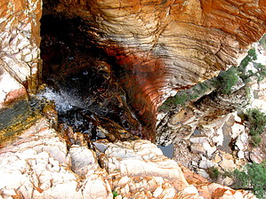
Turn left down into an unnamed tributary of the North Fork of Deadman Creek Canyon. Head down 0.55mi to the North Fork of Deadman Creek(-440ft) and turn right and head up the canyon 0.5mi. If only it was that easy. You reach a tiered set of falls stacked about 30ft then 65ft just about a 150ft before reaching the 250ft falls of choice.
Canyon Exit Route: by joe bartels
You may view the falls from below using this side canyon. It is very steep. There is a fair amount of vegetation to hurdle. That being said, most avid outdoorsmen that make it this far shouldn't have any trouble. You can not see the full waterfall from the bottom.
Rappelling Falls: by azflyguy
3A/C V with 7 rappels Sandy Saddle falls max 240' or 8 rappels max 190' North Fork falls if completing upper, middle, and lower canyon. Several bailout options if necessary and a gnarly exit after the lower falls.
WARNING! Hiking and outdoor related sports can be dangerous. Be responsible and prepare for the trip. Study the area you are entering and plan accordingly. Dress for the current and unexpected weather changes. Take plenty of water. Never go alone. Make an itinerary with your plan(s), route(s), destination(s) and expected return time. Give your itinerary to trusted family and/or friends.
Permit $$
None
Directions
Road
FR / Dirt Road / Gravel - Car Okay
To Barnhardt Trailhead From the corner of SR87 & SR260 in Payson go south on SR87 for 14.5 miles to the signed turnoff for Barnhardt trailhead (forest road 419). Follow FR419 5 miles to its end. The parking area is fairly large. Barnhardt trailhead is located at the west end of the parking area. From Phoenix take SR87 north out of Mesa to Payson. The turnoff to the trailhead is 4mi north of the 188 intersection. (think rest stop)
From PHX (I-10 & AZ-51) 83.4 mi - about 1 hour 45 mins From TUC (Jct 1-10 & Grant) 182 mi - about 3 hours 4 mins From FLG (Jct I-17 & I-40) 126 mi - about 2 hours 31 mins
 Route Editor

 Overview