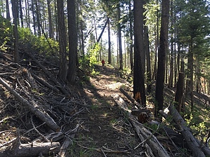
This spur trail leads from McKittrick Trail #72 to the old decommissioned lookout tower at the summit of Blue Peak (9,355 ft), the high point of the Blue Range Primitive Area. The junction for this spur trail is one mile east of the parking for the McKittrick Trail at the end of Forest Road 184.
The stats shown for this hike are for the out-and-back to the peak from the parking area at the end of FR184, which is what most people hike.
*Note: Blue Lookout Trail #71 does not go to Blue Peak. It begins along the McKittrick Trail and heads north, down into the drainage that ends at KP Creek.
WARNING! Hiking and outdoor related sports can be dangerous. Be responsible and prepare for the trip. Study the area you are entering and plan accordingly. Dress for the current and unexpected weather changes. Take plenty of water. Never go alone. Make an itinerary with your plan(s), route(s), destination(s) and expected return time. Give your itinerary to trusted family and/or friends.
 Route Editor

 This spur trail leads from McKittrick Trail #72 to the old decommissioned lookout tower at the summit of Blue Peak (9,355 ft), the high point of the Blue Range Primitive Area. The junction for this spur trail is one mile east of the parking for the McKittrick Trail at the end of Forest Road 184.