| Guide | ♦ | 1 Triplog | 0 Topics |
details | drive | permit | forecast | map |
stats |
photos | triplog | topics | location |
| 0 | 1 | 0 |
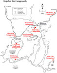
 Moqui Group Campground consists of three sites/pods, Simmons, Spooner, and Ernst. They are located off FR 138, approximately one mile from Arizona State Route 87 (milepost 298.8). This group campground is approximately 40 miles southwest of Winslow, 50 miles northeast of Payson and 70 miles southeast of Flagstaff, in a beautiful setting surrounded by mature ponderosa pine, oak, and quaking aspen. The elevation at the campground is 6,970 feet. Mogollon Rim Ranger District acknowledges, with gratitude, the donations and support extended by the Winslow Kiwanis Club in the development, concept, and construction of Moqui Group Campground. Moqui Group Campground consists of three sites/pods, Simmons, Spooner, and Ernst. They are located off FR 138, approximately one mile from Arizona State Route 87 (milepost 298.8). This group campground is approximately 40 miles southwest of Winslow, 50 miles northeast of Payson and 70 miles southeast of Flagstaff, in a beautiful setting surrounded by mature ponderosa pine, oak, and quaking aspen. The elevation at the campground is 6,970 feet. Mogollon Rim Ranger District acknowledges, with gratitude, the donations and support extended by the Winslow Kiwanis Club in the development, concept, and construction of Moqui Group Campground.Specifics: Each of the three individual pods can accommodate up to 50 people. Simmons and Ernst pods may be reserved together for groups up to 100 people (50 people per pod). Spooner pod has a 50 people limit. Groups with more than 100 people will need to consider going to the Elks Picnic Ground or the Long Valley Work Center. Moqui facilities include potable water, garbage service, ground grills, large pedestal barbecue grills, picnic tables, and restrooms. Spooner Pod is best suited for tent camping while Simmons and Ernst Pods can accommodate RVs up to 22 feet. Large refrigerated semi-trucks will not be permitted. Other special equipment must be pre-approved.
Usage: Medium Closest Towns: Happy Jack, AZ Water: Drinking Water Restroom: Vault Toilets Check out the Triplog. Leave No Trace and +Add a Triplog after your car camp trip to support this local community. | |||||||||||||||||||||||||||||||||||||||||||||||||||||
 Route Editor


