Route Editor

| Guide | ♦ | 1 Triplog | 0 Topics |
details | drive | no permit | forecast | route |
stats |
photos | triplog | topics | location |
| 51 | 1 | 0 |
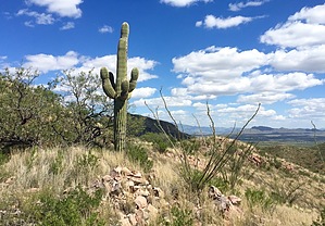
Rocky Ridgeline Fun by AZHiker456  Confusing prefixes, [thinking that ‘glyph’ meant ‘rock’], while heading up one of many rock-spine ridgelines that lead to the summit of what’s unofficially known as Glyph Mountain, it was easy to see how UN 4094 earned its unofficial name... or so I thought. Post-hike, it suddenly dawned on me that ‘petro’ = ‘rock/stone’; and ‘glyph’ = ‘symbol/carving’. Needless to say, I probably missed out on some sweet petroglyphs. However, regardless of whether or not petroglyphs or other types of glyphs are to be found on Glyph Mountain, one thing’s for certain: the many rock-spine ridgelines to choose from, coupled with exceptionally beautiful scenery, will make for one awesome off-trail adventure. Confusing prefixes, [thinking that ‘glyph’ meant ‘rock’], while heading up one of many rock-spine ridgelines that lead to the summit of what’s unofficially known as Glyph Mountain, it was easy to see how UN 4094 earned its unofficial name... or so I thought. Post-hike, it suddenly dawned on me that ‘petro’ = ‘rock/stone’; and ‘glyph’ = ‘symbol/carving’. Needless to say, I probably missed out on some sweet petroglyphs. However, regardless of whether or not petroglyphs or other types of glyphs are to be found on Glyph Mountain, one thing’s for certain: the many rock-spine ridgelines to choose from, coupled with exceptionally beautiful scenery, will make for one awesome off-trail adventure.Hike (Note: the route I’ve detailed below is just one of many possibilities; the mountain looks approachable from many other fun-looking ridgelines as well): Starting from the parking area I’ve described below, continue along the unnamed dirt road for approximately eight-tenths of a mile, at which point you can head left around Cerro Colorado Tank or go to the right. Heading left allows you the option of summiting Cerro Colorado while your legs are still fresh, so this is what I opted for.
The summit views are phenomenal and very similar to those from the nearby Cerro Colorado, with immediate views of the Cerro Colorado Mountains directly to the NE, and then further off are the Santa Rita Mountains to the East, the Tumacacori Mountains to the South, and the Baboquivari to the NW. At 4,094, Glyph Mountain sits slightly lower than the nearby Cerro Colorado (4,207’); however, because it’s closer to the larger, Cerro Colorado range, I thought the views from Glyph are better and more interesting. There is a summit register nestled under the obvious summit cairn. Unlike the nearby Cerro Colorado peak, this summit gets very little action. I did not see any trash atop the summit, thankfully; and the ‘log’, [which consists of a single small notebook page from the Southern Arizona Hiking Club], had only four sign-ins since July 10, 2004. For my descent, I headed toward the prominent point that is almost due East and slightly North of the highpoint. There is a really large cairn on this prominent point, which is visible from the highpoint. Next, I headed off a ridge toward the NE and then bushwhacked a short ways NE & N, landing on a dirt road that loops around and eventually, [about 3.3 miles later] reconnected with my approach tracks right by Cerro Colorado Tank. From there, simply hang a left and continue for another eight-tenths of a mile back to your vehicle. Gate Policy: If a gate is closed upon arrival, leave it closed after you go through. If it is open, leave it open. Leaving a closed gate open may put cattle in danger. Closing an open gate may cut them off from water. Please be respectful, leave gates as found. The exception is signage on the gate directing you otherwise. Check out the Official Route and Triplog. Leave No Trace and +Add a Triplog after your hike to support this local community. | ||||||||||||||||||||||||||||||||||||||||||||||||||||||||||||||||||||||||||||||||||