username
X
password
register
for free!
help
 This is likely a great time to hike this trail!  Check out "Preferred" months below, keep in mind this is an estimate.
   🔥

Ernie Maxwell Scenic Trail 3E07, CA

Guide 3 Triplogs  0 Topics
  4 of 5  
Fav
Wish
1
details
drive
permit
forecast
🔥
route  
stats
photos
triplogs
topics
location
10 3 0
Statistics
tap row or icons for details
Difficulty 0.5 of 5
Distance One Way 2.4 miles
Trailhead Elevation 6,419 feet
Elevation Gain -700 feet
Accumulated Gain 137 feet
Kokopelli Seeds 2.86
unreported if dogs are allowed
editedit > ops > dogs to adjust
feature photo
Photos Viewed All MineFollowing
4  2023-08-18
Tahquitz Rock
pseudalpine
4  2021-06-22 fricknaley
6  2017-07-31 TJHIKER
Author
author avatar Guides 16,843
Routes 17,472
Photos 24
Trips 1 map ( 6 miles )
Age 28 Male Gender
Location HAZ, TrailDEX
Associated Areas
list map done
Big Bear - Jacinto Region
Historical Weather
Trailhead Forecast
Radar Map
Expand Map
Preferred May, Oct, Jun, Sep
Sun  5:23am - 6:07pm
Official Route
 
1 Alternative
 
Historic Fire Perimeteracres
🔥 2018 Cranston Fire13.2k


remove free decal offer

 Likely In-Season!
Guide Needed
Publish Full Detail Guide


Use +Add above to share photos and triplogs
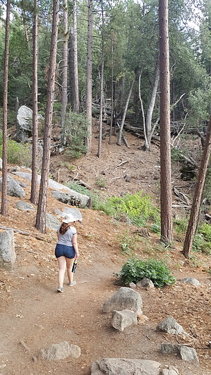
This easy, scenic, hike begins at 6400 ft. and crosses seasonal streams along the way. It descends 700 feet from Humber Park. It is a good walk for beginning botanists; many different species of trees can be found along the way. There are also good views of Suicide and Lily Rocks. This trail goes into the San Jacinto Wilderness area and mountain bikes are not allowed.


    Check out the Official Route and Triplogs.
    Leave No Trace and +Add a Triplog after your hike to support this local community.

    One-Way Notice
    This hike is listed as One-Way.

    When hiking several trails on a single "hike", log it with a generic name that describes the hike. Then link the trails traveled, check out the example.
    WARNING! Hiking and outdoor related sports can be dangerous. Be responsible and prepare for the trip. Study the area you are entering and plan accordingly. Dress for the current and unexpected weather changes. Take plenty of water. Never go alone. Make an itinerary with your plan(s), route(s), destination(s) and expected return time. Give your itinerary to trusted family and/or friends.

     Permit $$
    no fees or permits reported

    if incorrect tell us about it

    San Bernadino Forest
    Visit the San Bernadino Passes & Permits for current information


     Directions
    or
     Road


    To hike
    page created by joebartels on Aug 04 2017 3:18 pm
     90+° 8am - 6pm kills
    helpcorrectionissue

    end of page marker