|
tap row or icons for details
|
| Difficulty |
|
1.5 of 5 |
| Distance One Way |
|
10.8 miles |
| Trailhead Elevation |
|
5,743 feet |
| Elevation Gain |
|
-2,400 feet |
| Accumulated Gain |
|
1,000 feet |
| Kokopelli Seeds |
|
14.13 |
| Interest Seasonal Creek & Perennial Creek | | unreported if dogs are allowed
editedit > ops > dogs to adjust |
| | |
|
|
12 |
2021-05-13 |
Observation Point - Zion |
ddgrunning |
|
|
|
18 |
2020-11-03 |
Zion - Observation Point via East Rim Trail |
BiFrost |
|
|
|
8 |
2018-05-04 |
West Rim Trail - Zion |
toddak |
|
|
| |
|
|
list |
map |
done |
Southwest Region |
| | |
|
| |
|
|
Historical Weather |
| Trailhead Forecast | | |
|
 |
|
|
| Preferred Oct, Apr, May, Mar |
|
|
| | |
| |
Named Locations Coordinate Links
| |
|
| help future hikers |
| post a gps route now |
|
Observation Point - Zion
|
9.94 mi
2,372 ft |
 |
| Zion - Observation Point via East...
|
10.26 mi
2,676 ft |
|
|
| | |
| |
|
|
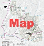
 East Entrance station to the Weeping Rock shuttle stop. This trail travels through the forested mesas of eastern Zion. The path gradually climbs over 1000 feet (with some sections of soft sand), then descends 2400 feet into Zion Canyon. Along the way are views of the massive sandstone cliffs and canyons of Zion. This trail also accesses the Deertrap, Cable Mountain and Observation Point Trails, and connects to the East Mesa and Stave Spring Trailhead.
One-Way NoticeThis hike is listed as One-Way. When hiking several trails on a single "hike", log it with a generic name that describes the hike. Then link the trails traveled, check out the example. |
 Route Editor


