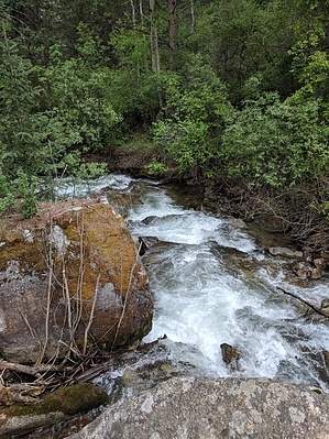
The Two Elk trail starts and/or ends at Forest Road 762 near Minturn and the Vail Pass / Tenmile Canyon National Recreation Trail in East Vail: This trail is popular as a one-way "shuttle hike" where people will leave a car at one end and drive a second car to their trailhead. From the east end, it travels through the cool shady Timber Creek Canyon, climbs a steep section to the Two Elk Pass summit with views of the Gore Range, Sawatch Range, and Vail's Back Bowls, and descends slowly through meadows and the valley between Vail’s Back Bowls and Blue Sky Basin Bowls finally emerging from the last section of cool aspen-pine forest to the west trailhead.
When hiking several trails on a single "hike", log it with a generic name that describes the hike. Then link the trails traveled, check out the example.
WARNING! Hiking and outdoor related sports can be dangerous. Be responsible and prepare for the trip. Study the area you are entering and plan accordingly. Dress for the current and unexpected weather changes. Take plenty of water. Never go alone. Make an itinerary with your plan(s), route(s), destination(s) and expected return time. Give your itinerary to trusted family and/or friends.
Permit $$
no fees or permits reported
if incorrect tell us about it
Directions
Road
To hike EAST TRAILHEAD: Travel east on I-70 to exit 180 for East Vail. Turn right and travel 2.3 miles east on the south frontage road, passing under the interstate and past the Gore Creek Campground. Park just beyond at the road closure gate and walk 1.8 miles up the old Vail Pass road, today’s recreation path, to the Two Elk trailhead on the right.
WEST TRAILHEAD: Travel west on I-70 to exit 171 for Minturn, Leadville, and Hwy 24. Turn right and travel south 2.7 miles and into Minturn to Cemetery Bridge. Turn left, cross the bridge and tracks, then proceed south past the cemetery. Go right at the first fork and left at the second fork. Follow this somewhat rough dirt road about 1.8 miles and park at the trailhead at the end.
 Route Editor


