username
X
password
register
for free!
help
 This is likely a great time to hike this trail!  Check out "Preferred" months below, keep in mind this is an estimate.
 

Martin Creek Trail #2128, CO

Guide 2 Triplogs  0 Topics
  0 of 5  
Fav
Wish
0
details
drive
no permit
forecast
map
stats
photos
triplogs
topics
location
18 2 0
Statistics
tap row or icons for details
Distance One Way 0 miles
Trailhead Elevation 7,964 feet
unreported if dogs are allowed
editedit > ops > dogs to adjust
feature photo
Photos Viewed All MineFollowing
6  2018-06-16 Pivo
12  2018-06-03 Pivo
Author
author avatar Guides 16,843
Routes 17,472
Photos 24
Trips 1 map ( 6 miles )
Age 28 Male Gender
Location HAZ, TrailDEX
Associated Areas
list map done
Northwest Region
Historical Weather
Trailhead Forecast
Expand Map
Preferred Jun, Sep, Aug, Jul
Sun  5:37am - 6:31pm
2 Routes
 
0 Alternative


remove free decal offer

 Likely In-Season!
The Martin Creek trail begins in Minturn and ends at Grouse Mountain Trail #2010

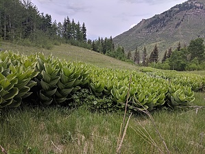
The trail climbs steadily as it follows an old road through aspen and then lodgepole. The trail passes the remains of several old cabins and offers good views of Cross Creek Valley and Mount of the Holy Cross. At about 6 miles, hikers can turn right onto the Grouse Mtn Connector Trail #2010 toward West Grouse Creek Trail #2129 or continue left toward Cross Creek Trail #2006.


2018-07-14 HAZ_Hikebot


    Check out the Triplogs.
    Leave No Trace and +Add a Triplog after your hike to support this local community.

    One-Way Notice
    This hike is listed as One-Way.

    When hiking several trails on a single "hike", log it with a generic name that describes the hike. Then link the trails traveled, check out the example.
    WARNING! Hiking and outdoor related sports can be dangerous. Be responsible and prepare for the trip. Study the area you are entering and plan accordingly. Dress for the current and unexpected weather changes. Take plenty of water. Never go alone. Make an itinerary with your plan(s), route(s), destination(s) and expected return time. Give your itinerary to trusted family and/or friends.

     Permit $$
    no fees or permits reported

    if incorrect tell us about it


     Directions
    or
     Road


    To hike
    Travel west from Vail on I-70 to Exit 171 for Minturn. Exit here and head south on US 24 for about 2.3 miles to the south edge of Minturn. After you pass the Battle Mountain Trading Post, turn right on a dirt road just before a blue house. The trail starts up the hill at the end of the drive. Private property surrounds the trailhead; please respect the owner’s rights.
    page created by joebartels on Jun 03 2018 2:18 pm
     90+° 8am - 6pm kills
    helpcorrectionissue

    end of page marker