 Route Editor

| Guide | ♦ | 22 Triplogs | 0 Topics |
details | drive | no permit | forecast | route |
stats |
photos | triplogs | topics | location |
| 90 | 22 | 0 |
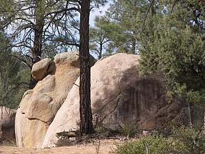
Circle the Peak by Dschur   Payson Area trails system (PATS) is an in-process interconnecting trail system. They will be using roads, sidewalks, existing forest trails, and roads as well as new trails. Some trails are outside the city limits of the Town of Payson as well as going thru town. Payson Area trails system (PATS) is an in-process interconnecting trail system. They will be using roads, sidewalks, existing forest trails, and roads as well as new trails. Some trails are outside the city limits of the Town of Payson as well as going thru town.Some of the trails are completed but there are still some that they are working on. The Monument Peak Loop trail starts at either a small pull-off on the east side of the Granite Dells road. If that small parking area is full you can continue down the trail for about .5 miles to the Boulder Loop/Monument Peak Loop parking area. There is a bigger area here for more cars. The only thing about this area is that there are many trails that ATVs have used all around and you have to pay attention to the marked signs for the PATS system.
The trail starts to either the right or the left of the parking area. I went backward from the MP markers along the way. If you start to the south and go counterclockwise. Or to the north and go clockwise. I will describe it counterclockwise. You are going around Monument Peak which you can see all along the way. The trail is a very well-marked easy trail with many trail signs as well as where the ATVs ride. Continue down the path you will see mile markers along the pathway. You will pass a little pond/tank next to the trail and then the path winds next to some houses before it comes on back around heading to the trailhead. Here the trail follows along a little creek. It runs along back and forth across the trail and on each side before it disappears into the ground as a little spring. It was flowing in June and was nice and clear. (no ATVs had run thru it yet). At one point it follows the trail itself. The trail then climbs slightly and back down to finish up at the road and the trailhead. The trail is made of decomposed granite and can be a little slick like ball bearings. The trail is a good one for all people and ages.
Check out the Official Route and Triplogs. Leave No Trace and +Add a Triplog after your hike to support this local community. One-Way Notice This hike is listed as One-Way. When hiking several trails on a single "hike", log it with a generic name that describes the hike. Then link the trails traveled, check out the example. | ||||||||||||||||||||||||||||||||||||||||||||||||||||||||||||||||||||||||||||||||||||||||||||||||||||||||||||||||||||||||||||||||||||||||||||||||||||||||||||||||||||||||||||||||||||||||||


