 Route Editor

| Guide | ♦ | 1 Triplog | 0 Topics |
details | drive | no permit | forecast | route |
stats |
photos | triplog | topics | location |
| 0 | 1 | 0 |
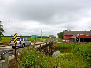
A Bridge Too Far by kingsnake  The Ice Age National Scenic Trail is a 1,200 mile trail that travels from the St. Croix River an hour northeast of Minneapolis, east towards Antigo, south to New Glarus -- home of an awesome microbrew -- east to Whitewater, then north to Sturgeon Bay, in scenic Door County, Wisconsin. The route roughly follows the "terminal moraine" -- the maximum glacial advance -- from the last Ice Age, which ended about 10,000 B.C. The Ice Age Trail is administered by the National Park Service, and is maintained by various public and private agencies.
Hike This segment starts from the trailhead on the north side of WI-28. It is short, and basically flat. (The *only* "climb" is 40 ft.) Like other segments further north, the trail is firm, only occasionally muddy, with occasional rocks & roots, through dense, dark, deciduous forest. Shelter #1 is only a quarter mile north of County H, in case the Milwaukee River is a bridge too far. Really, that's it: It's two miles. What did you expect? By the way, an out & back hike is 4.0 mi. / 325 AEG. Combined with the next segment south, to Kewaskum, an out & back hike is 12.0 mi. / 1000 AEG. Check out the Official Route and Triplog. Leave No Trace and +Add a Triplog after your hike to support this local community. One-Way Notice This hike is listed as One-Way. When hiking several trails on a single "hike", log it with a generic name that describes the hike. Then link the trails traveled, check out the example. | |||||||||||||||||||||||||||||||||||||||||||||||||||||||||||||||||||||||||||||||


