username
X
password
register
for free!
help
 This is likely a great time to hike this trail!  Check out "Preferred" months below, keep in mind this is an estimate.
  

Tilly Jane Ski Trail #643, OR

Guide 1 Triplog  0 Topics
  0 of 5  
Fav
Wish
0
details
drive
permit
forecast
route  
stats
photos
triplog
topics
location
12 1 0
Statistics
tap row or icons for details
Difficulty 4 of 5
Distance One Way 2.58 miles
Trailhead Elevation 3,814 feet
Elevation Gain 1,877 feet
Accumulated Gain 1,877 feet
Kokopelli Seeds 8.84
unreported if dogs are allowed
editedit > ops > dogs to adjust
feature photo
Photos Viewed All MineFollowing
Will recalculate on button tap!
12  2019-01-29 keepmoving
Author
author avatar Guides 16,843
Routes 17,472
Photos 24
Trips 1 map ( 6 miles )
Age 28 Male Gender
Location HAZ, TrailDEX
Associated Areas
list map done
North Central Region
Historical Weather
Trailhead Forecast
Radar Map
Expand Map
Preferred Jul, Aug, Sep, Jun
Sun  5:31am - 6:39pm
Official Route & 1 Rt
 
0 Alternative


remove free decal offer

 Likely In-Season!
This trail is on the northeast side of Mount Hood. The trail is a popular cross-country ski trail in the winter.


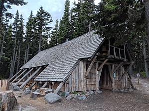
This trail begins at Tilly Jane Campground and ends near Cooper Spur Ski Area at Forest Road 3512. From The Tilly Jane Campground, the trail heads downhill (east) and immediately reaches the junction with Tilly Jane Trail #600A. Continue downhill (east) 0.1 to the Tilly Jane Shelter. From the shelter, the trail continues downhill and after 1.9 miles reaches the junction with Polallie Ridge Trail #643A. The trail bears left from the junction and follows Doe Creek 0.7 miles to the end of the trail at Forest Road 3512 near Cooper Spur Ski Area.

2019-02-14 HAZ_Hikebot


    Check out the Official Route and Triplog.

    Note
    This is a moderately difficult hike.
    Leave No Trace and +Add a Triplog after your hike to support this local community.

    One-Way Notice
    This hike is listed as One-Way.

    When hiking several trails on a single "hike", log it with a generic name that describes the hike. Then link the trails traveled, check out the example.
    WARNING! Hiking and outdoor related sports can be dangerous. Be responsible and prepare for the trip. Study the area you are entering and plan accordingly. Dress for the current and unexpected weather changes. Take plenty of water. Never go alone. Make an itinerary with your plan(s), route(s), destination(s) and expected return time. Give your itinerary to trusted family and/or friends.

     Permit $$
    no fees or permits reported

    if incorrect tell us about it

    Mount Hood Forest
    more info


     Directions
    or
     Road


    To hike
    From Hood River, OR - travel approximately 22.2 miles south on Oregon Hwy 35 to Polallie Trailhead, approximately 0.3 miles south of milepost 74, and turn right (west) onto Cooper Spur Road. Follow Cooper Spur Road 2.4 miles to Cloud Cap Road (Forest Road 3512) and turn left (southeast). Follow Cloud Cap Road (Forest Road 3512) approximately 8.7 miles to the trailhead at Tilly Jane Campground.
    page created by joebartels on Jan 30 2019 7:55 pm
     90+° 8am - 6pm kills
    helpcorrectionissue

    end of page marker