 Route Editor

| Guide | ♦ | 48 Triplogs | 0 Topics |
details | drive | no permit | forecast | route |
stats |
photos | triplogs | topics | location |
| 8 | 48 | 0 |
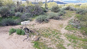
Shaped like one, but a stinger it ain't. by CannondaleKid  Warning WarningThis trail is designed for and primarily to be used by mountain bikers, but you may encounter hikers, equestrians, and yes, even wild horses, so be aware. Overview This is another mountain bike trail added to the Hawes Trail System in February 2019. This trail begins at a point along Wild Horse Trail 1.6 miles east of Bush Highway and ends back at the Wild Horse Trail 2.2 miles east of Bush Highway. It follows a clockwise 'scorpion stinger-shaped' arc, which is why it is named 'Stinger'.
0 to 0.5 mi = Relatively easy single-track with a few tight spots, gradually losing elevation. 0.5 to 0.7 mi = Quickly transitions into a technical section, probably the toughest of the trail. 0.7 to 0.9 mi = Medium difficulty single-track with a few short climbs. 0.9 to 1.0 mi = Another technical section lasting only half as long as the first technical section. 1.0 to 1.2 mi = Easy single-track across a flat area featuring a small wood bridge over a narrow wash. 1.20 mi = Stinger/Scorpion Alley junction. Scorpion Alley comes in from the east. 1.25 mi = Ride up a small rock outcrop and over the yellow-orange roof of a 1966 Volkswagen. 1.3 to 2.1 mi = Relatively easy single-track, steadily gaining altitude. I rode this last section in the opposite direction and it is a real blast! I only pedaled for maybe 100 feet of the whole 0.8-mile section yet was able to keep my speed up the whole time providing for a smooth flowing effect. Hike Easy... no sandy washes, no thorny stuff, nothing steep, just a nice hard-packed surface... or it will be as soon as it gets more traffic. Check out the Official Route and Triplogs. Leave No Trace and +Add a Triplog after your hike to support this local community. One-Way Notice This hike is listed as One-Way. When hiking several trails on a single "hike", log it with a generic name that describes the hike. Then link the trails traveled, check out the example. | |||||||||||||||||||||||||||||||||||||||||||||||||||||||||||||||||||||||||||||||||||||||||||||||||||||||||||||||||||||||||||||||||||||||||||||||||||||||||||||||||||||||||||||||||||||||||||


