 Route Editor

| Guide | ♦ | 1 Triplog | 0 Topics |
details | drive | no permit | forecast | route |
stats |
photos | triplog | topics | location |
| 46 | 1 | 0 |
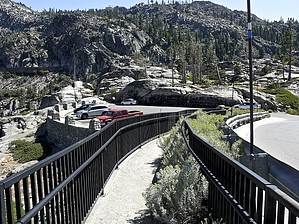
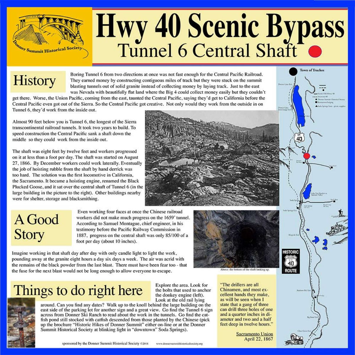
dramatic event by AZClaimjumper geotagged photoset Hike Clockwise This hike begins in the parking area next to Rainbow Bridge.
Once you get above the China Wall you will be on what used to be a railroad bed & tracks. Proceed West through Tunnel 7 & then Tunnel 6 which is 1525' long. the Tunnel floor is wet so be sure to wear shoes/boots that will keep your feet dry. Once you emerge from the West end of Tunnel 6 you' circumvent a parking area & shortly arrive at the Historic Summit Hotel. The only thing you'll see are a few things that tells you there was a structure here at one time. Continue your hike along the road past Lake Mary & the Historic Lake Mary Cabin. After a short 1/3 mile, you hike past the Pacific Crest Trailhead continue hiking another 0.3 miles till you come to a parking area & the Central Shaft Historical Marker which explains that by digging this vertical shaft, the Chinese Laborers were able to start digging on 4 faces of the Tunnel, two faces going from inside to outside entrances & 2 faces going from the outside in toward the Central Shaft. From The Central Shaft, you'll hike out to the ByPass 40 road, hike approximately 1/4 mile until you come to the trail on the right side of the road heading North up toward Lake Angela & Catfish Pond. The trail up is well-maintained & easy to stay on. You'll come to a nice overlook of the China Wall after about 1/4 mile. You'll want to stop & take photos. After another approximate 1/4 mile, you come to the controversial Stephens Pass Emigrant Trail Marker. From there you move in a general NW direction which will lead you to Lake Angela. Retrace your track back to the trail, once back on the trail a short 1/10 of a mile & you'll arrive @ Catfish Pond, which was built by the Chinese when they were digging tunnel 6. It became a reliable source of food for the Chinese laborers, the kind of food they were used to eating. This is the perfect shaded spot to stop for a nutrition break. From Catfish Pond the trail is up & over huge slabs of granite that are now clearly identified with a white paint spot & a Red paint spot centered in the white spot; once over the granite at the peak elevation of 7,267', you'll intersect with the well-traveled, tree-canopied Pacific Crest Trail & from there on it's all downhill; the early part of the descent includes 11 switchbacks. After all the switchbacks you'll eventually intersect with Hwy 40 Scenic Bypass 2-lane road at which point if you look east you can Rainbow Bridge just a little more than a stone's throw away. Walk over Rainbow Bridge & you're now back in the parking lot where you began. Historical Note The ill-fated Donner Party crossing 1846 was a DRAMATIC event. The Stephens-Townsend-Murphy Party in 1844 was a HISTORICAL event because they were the first to cross the Sierras into California TWO YEARS BEFORE THE DONNER PARTY & all 50 members + 2 babies were born & lived while traveling, ALL SURVIVED. Here is a fascinating article that tells of similarities & differences between the Donner Party & the Stephens-Townsend-Murphy Party, entitled The SMART Ones Got Through. Ghosts of Gold Mountain is a book written about the 15,000 Chinese who built the Central Pacific Railroad from Sacramento to Promontory Point. Sadly, the Chinese were denied U.S. Citizenship when they applied.
Check out the Official Route and Triplog. Leave No Trace and +Add a Triplog after your hike to support this local community. | |||||||||||||||||||||||||||||||||||||||||||||||||||||||||||||||||||||||||||||||||||||||||||||||


