|
| | | |
| |
|
| Hiking | 7.25 Miles |
2,285 AEG |
| | Hiking | 7.25 Miles | 9 Hrs 40 Mns | | 0.75 mph |
| 2,285 ft AEG | | 18 LBS Pack | | |
|
|
| |
| Partners |
|
none
[ show ]
| no partners | | Go Here to see my high resolution photo set: http://www.flickr.com/photos/bc_az/sets ... 093810012/
Thanks to Woarnoart, Grasshopper, Sredfield, HikeArizona.com, Mother Nature, & Father Time, I successfully made the clockwise hike up Carney Springs TH to Ridgeline Trail, over to Robbers Roost, past it & down to Fremont Saddle, over to Geronimo's Cave & down the GC trail to Peralta TH, then over to CS TH where I'd parked my car.
I'd been unsuccessful the prior weekend because I couldn't figure out how to get around, over, under, or through Robbers Roost.
The supplementary .15 mile route, waypoints, & cairns that Grasshopper told me about, made all the difference.
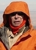
6:10 a.m. - arrived @Carney Springs Parking lot, got into my backpack, loaded my GPS with fresh batteries, calibrated my compass, pulled up this route on my GPS & started off.
6:30 a.m. - arrived at the gate/trail head wearing only a T-Shirt top on a cool & comfortable 48? morning. I figured it would take me 3.5 hours to reach Ridgeline trail intersection, the time it took me last weekend.
7:50 a.m. arrived at False Summit (3,227'), decided to take a nutrition break after taking a photo of what lies ahead on my way toward Ridgeline Trail intersect.
8:45 a.m. I'm standing at the Ridgeline Trail/Carney Springs trail interesection & overjoyed that I got up here in only 2.5 hours. Last week it took me 3.5 hours to reach this point. I'm overjoyed. Took a restful nutrition break then began my trek toward Robbers Roost. I frequently looked my my GPS route that woarnoart gave me which helped to keep me "on track".
?:?? a.m. - I wish I'd taken a photo or recorded the time I arrived at the first waypoint on a supplementary route provided by grasshopper, but I didn't. The cairn was more like a monument.
From the first waypoint, the cairn were frequent & quite noticeable, leaving me no doubt that I was on track. When I got to the last waypoint on the supplementary route, which was leading me down & into Robbers Roost, I made a decision to STOP, to come back to Robbers Roost another day. I retraced my steps back up to the 2nd waypoint, then switched my GPS route to woarnoart's & continued toward Fremont Saddle.
10:40 a.m. - 2 ggggreat photos of Geronimo's Cave, the close up photo will knock your socks off (it's taken with a 600mm telephoto lens & it looks like I'm standing right in front of the cave. Later in the day, I'll be standing in the cave along with 4 others that I met @Fremont Saddle that decided to join me on down the Geronimo Cave Trail instead of going back down the Peralta Trail.
11:40 a.m. - Took the obligatory photos of Weaver's Needle looking through the Gunsight rock formation.
11:50 a.m. - Met a young, nice looking couple on Fremont Saddle & we struck up a conversation. Seems that this was their first hike up the Peralta Trail & they were getting ready to go back down.
I told where I'd been & where I was going & offered to lead them down the Geronimo Cave Trail. They asked me to give them a couple of minutes to talk things over. When they came back they told me they had two pre teen, one boy, one girl, pointed to them as they were climbing over some rocks & asked IF I would be willing to accept all 4 of them. I agreed.
I'd hiked the Geronimo Cave loop clockwise & counter clockwise, showed them my GPS, explained that the dar blue arrow was exactly where we were & the light blue route was what we wanted to stay on.
Having 2 adults & 2 children made this part of the hike so much more enjoyable because now I had people to talk to. I turned it into an educational adventure for parents & the kids. Cairns, none of them had ever heard the word before, so I explained that they were trail signs, just like road signs. I made a game out of finding cairns as we proceed toward the cave. At first none of them could see the cairns, in short order each person began to joyfully shout out with glee when they were the first to spot one in the distance. I appointed each child to be the leader for a while & asked them to tell me when they saw a cairn & which direction we needed to go. When we got to Geronimo's Cave I took their photo with their cell phone camera. We took a nutrition break & I showed them the photos I'd taken earlier in the day of Geronimo's Cave. They were clearly impressed when I pointed to where I'd been standing when I took the photos. I again gave the parents the option to turn back if they wished, however I think their children would have Mutinied if their parents had opted to go back.
The parents & kids really wanted to continue on with me. At this point the kids were taking turns being the leader & doing a real good job of keeping us on track. I gave my GPS to the whoever was the leader & taught them how to make sure they were leading us & keeping us on track.
I told them about HikeArizona.com & how I was able to download the route into my GPS, it was something anyone could do, something they can & should do, so they can embark on some other loop hikes in the Sups, or wherever they might be in Arizona.
After going past the Bathtub & the Citadel rock formations, I began to tire, was having to take frequent rest stops & really slowing them down. I offered & suggested several times that they go on without me, that they wouldn't hurt my feelings & that I knew I was holding them back. I told them that I thought they were now skilled enough to be able to stay on the trail without me.
Finally, they decided to accept my offer, while I was sitting in the shade of a rock, resting. Each came up to me & thanked me for adding to their outdoor adventure.
IF I'd taken the time to go into & explore Robbers Roost, I'd not have connected with this family of four.
Incidentally, this is not the first time I've picked up other hikers that decided to join me down the Geronimo Cave trail & it won't be the last.
I continued to take frequent rest breaks, it was early in the afternoon & I had the rest of the day all to myself & the Sups.
Signed the log at Peralta Trail Head & then hiked down the road & back to the Carney Springs parking lot.
3:58 p.m.- arrived at the CS parking lot & took a photo of my car to record the time & to show off my HikeArizona.com decal on right side of the trunk lid, although it doesn't show up to well because it was in the shadow & everything is in bright daylight.
I began my hike with 2 Hydrapak bladders, one holds 100 oz of water, the other holds 50 oz. although I only put 20 oz of fluid in it.
When I got home I measured what was left & figured I drank 70 oz out of the big bladder. I never drank any Powerade out of the small bladder which was my "reserve". The Hydrapak bladder & complete delivery system is guaranteed for my lifetime, free replacement of any components that break, leak, or quits working. It's better than Camelbak bladders/delivery system in every respect & costs the same.
Thanks, again woarnoart, grasshopper, Sredfield, & HikeArizona.com for giving me what I need to make loop hikes in the Sups. |
| _____________________
| | |
|
|
|
 Route Editor


 Here is a link to the
