| Guide | ♦ | 2 Triplogs | 0 Topics |
details | drive | no permit | forecast | route |
stats |
photos | triplogs | topics | location |
| 0 | 2 | 0 |
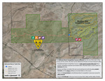
Leisurely Walk by markthurman53  Overview OverviewThe Daheste Loop Trail is located in the McKenzie Ranch Trails Park in Far East Pima County north of Marsh Station Road on the southern slopes of Rincon Peak. There are two loop trails in the park, Lozen at 6.5 miles and the Daheste at 3.4 miles. There is also a 3 mile trail that heads west and goes to Marsh Station Road at Agua Verde Road. These trails were built for Mountain bikers and maintained by them also. The trails are fairly new just opening in 2018. Hiking is allowed when no racing events are occurring but must be done in the counterclockwise direction (bikers go clockwise). McKenzie Park was named after Asa McKenzie from Virginia who established a ranch in the area in 1860. Lozen (1840 – 1889) and Dahteste (1860 – 1955) are both Apache women warriors. I am not sure why the trail spelling is different from the Apache Dahteste.
From the parking area off Red Hill Ranch Road Head south along the Lozen Loop trail if hiking (If biking head north then take the Lozen Link to the Daheste Trail). Head south on the Lozen Trail for 0.5 miles to an intersection. At this intersection the Daheste Trail continues east and the Lozen Trail veers off to the north. This is a very well maintained trail, no need to step over logs rocks or steps. This trail is located in the hills between the Agua Verde and Cienega Creeks and doesn’t really have a destination; it just contours the hills along two fingers of a creek that eventually drains into Cienega Creek. The Daheste Trail continues on for 3.4 miles before reconnecting with the Lozen Trail. Once at the Lozen Trail you have to head north on the Lozen Trail maintaining the Counter Clockwise direction. There are two options from this trail junction; continue on the Lozen 0.3 miles to the Lozen Link Trail that will take you back to the trail head for a 5 mile loop or continue on the Lozen Trail back to the trailhead for a close to 10 mile loop. The vegetation and nearby scenery is kind of bland but the views to the south of the Empire and Santa Rita Mountains are good. There are also great Views looking up to Rincon Peak and to the west of the Quinlan Mountains. Because of the great trail conditions this trail requires very little concentration, allowing for you to take in the distant scenery even while walking. Check out the Official Route and Triplogs. Leave No Trace and +Add a Triplog after your hike to support this local community. One-Way Notice This hike is listed as One-Way. When hiking several trails on a single "hike", log it with a generic name that describes the hike. Then link the trails traveled, check out the example. | ||||||||||||||||||||||||||||||||||||||||||||||||||||||||||||||||||||||||||||||||||||||||||
 Route Editor


