 Route Editor

| Guide | ♦ | 9 Triplogs | 0 Topics |
details | drive | no permit | forecast | route |
stats |
photos | triplogs | topics | location |
| 79 | 9 | 0 |
Single track and jeep roads, hike it before the development gets there by DarthStiller  The north end of this segment of the trail is one of the few spots that has a trailhead that is solely dedicated to the Maricopa Trail, named the Trilby Trailhead. The trailhead has very sparse amenities, consisting of gravel, under ten parking spots, and a kiosk with a map of the local area and trail. The north end of this segment of the trail is one of the few spots that has a trailhead that is solely dedicated to the Maricopa Trail, named the Trilby Trailhead. The trailhead has very sparse amenities, consisting of gravel, under ten parking spots, and a kiosk with a map of the local area and trail.Heading in a general southwest-bound direction, take Santa Fe Drive towards 163rd Ave. and cross Route 60. Markers for the MT are few in this area, so it helps to have a GPS track. After crossing Route 60, the markers direct you to some single track that eventually turns into lighter jeep roads. The single-track section parallels Route 60 for almost a mile. Some trash has been dumped in this area, as well.
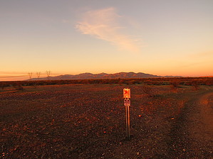
At the 6.5 mile mark, the trail intersects the Sun Valley Parkway. At this point, the trail takes a detour to the east to a bridge, going under the parkway, and then back. Altogether, this jog in the trail takes up about a mile. Once past the Sun Valley Parkway, the trail becomes primarily single-track. The surrounding area is still undeveloped and the flora is more native desert. The White Tank mountains come more into focus from the west. Also coming into focus is a powerline that the trail parallels for the next few miles, crossing under at one point. To the southeast, South Mountain and the Estrellas is visible, although distant. To the east, Four Peaks and the Superstitions are at times recognizable, but much smaller. To the north, the mountains near Lake Pleasant are very prominent. After a few jogs, the trail heads straight towards the White Tank Mountains in a southwestern direction. At just over 12 miles from the Trilby Trailhead, the trail makes a 90-degree bend to the northwest towards the White Tank Mountains and enters it at the 13-mile mark. For the next 2.6 miles, the Mule Deer Trail in White Tank Mountain Regional Park is designated as the MT. There are two spurs in this park. One is at the north entrance and continues another quarter mile northwest to the main Trailhead Staging Area inside White Tank Mountains. The second spur is the South Trail inside the park and is 0.1 miles from the end of the Mule Deer Trail to a small parking lot. Once it leaves White Tank Mountains, the trail heads in a southwest direction while descending into a valley with a saguaro forest. The trail heads in this direction for just under a mile, at which point the trail intersects Northern Avenue and follows a jeep road. The single track parallels the jeep road (Northern Ave) until the southern terminus of this segment, which is designated as an access point.
Check out the Official Route and Triplogs. Leave No Trace and +Add a Triplog after your hike to support this local community. One-Way Notice This hike is listed as One-Way. When hiking several trails on a single "hike", log it with a generic name that describes the hike. Then link the trails traveled, check out the example. | |||||||||||||||||||||||||||||||||||||||||||||||||||||||||||||||||||||||||||||||||||||||||||||||||||||||||||||||||||||||||||||||||||||||||||||||||||||||||||||||||||||||||||||


