Route Editor

| Guide | ♦ | 175 Triplogs | 0 Topics |
details | drive | no permit | forecast | route |
stats |
photos | triplogs | topics | location |
| 44 | 175 | 0 |
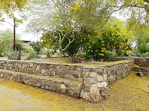
 The crosscut canal path runs from Indian School and 64th street in Phoenix to just northeast of Mill and Curry in Tempe. This paved, multi-use route is popular with cyclists, runners, walkers, and in-line skaters. There are access points at each major cross street, but no designated parking area on either end. The crosscut canal path runs from Indian School and 64th street in Phoenix to just northeast of Mill and Curry in Tempe. This paved, multi-use route is popular with cyclists, runners, walkers, and in-line skaters. There are access points at each major cross street, but no designated parking area on either end.The northern end links with the Arizona canal, and the southern end is a quarter-mile away from the eastern end of the grand canal. This SRP map calculates distances and locations for various canals in the valley. Check out the Official Route and Triplogs. Leave No Trace and +Add a Triplog after your road bike ride to support this local community. | ||||||||||||||||||||||||||||||||||||||||||||||||||||||||||||||||||||||||||||||||||||||||||||||||||||||||||||||||||||||||||||||||||||||||||||||||||||||||||||||||||||||||||