 Route Editor

| Guide | ♦ | 2 Triplogs | 0 Topics |
details | drive | no permit | forecast | 🔥 route |
stats |
photos | triplogs | topics | location |
| 0 | 2 | 0 |
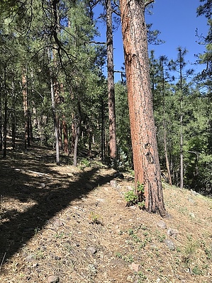
convenient connector by FOTG  Overview OverviewTrail #609 is a short connector trail in the eastern Primitive Blue Range. The trail provides a convenient connector for backpacking in the area as well as a nice section of trail for completing day hiking loops out of Bear Valley. Hike Trail 609 intersects with the Little Blue Trail #41 less than a mile downstream of Bear Valley. The trail junction is not marked. Trail 609 travels primarily through a mixed forest of hardwoods and healthy ponderosa. However, you can see some nice views of the unique geology of the Little Blue early in the hike. The trail mainly travels parallel to an unnamed drainage that is dry for most of the year. The trail is well marked and relatively easy to follow. As one nears the top of the trail, the forest gives way to juniper. The trail is perhaps a little fainter through here, and it may take a minute to identify the intersection with Cow Flat Trail #55.
There are no permanent water sources along this trail, however, Bear Valley Spring near the trail´s beginning is reliable. Camping There are several opportunities for camping along the trail. Note Auger is decommissioned. Albeit unmaintained, it is open to hiking as of this writing. Check out the Official Route and Triplogs. Leave No Trace and +Add a Triplog after your hike to support this local community. One-Way Notice This hike is listed as One-Way. When hiking several trails on a single "hike", log it with a generic name that describes the hike. Then link the trails traveled, check out the example. | |||||||||||||||||||||||||||||||||||||||||||||||||||||||||||||||||||||||||||||||||||||||||||||||||||||||


