| Guide | ♦ | 1 Triplog | 0 Topics |
details | drive | permit | forecast | route |
stats |
photos | triplog | topics | location |
| 4 | 1 | 0 |
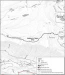
The trail levels slightly at the boundary and continue 0.5 miles to the foot of Mount Mitchell to the east (4,680’). The trail heads northeast around Mount Mitchell, climbs 0.7 miles and reaches the high point of the trail on the north side of the mountain (4,960’). From here, the trail begins a steep descent on several switchbacks 0.6 miles to Forest Road 5830. The trail exits the Roaring River Wilderness here. Visitors can return to the trailhead on this trail (#704). For those wishing to extend their hike, cross Forest Road 5830 and follow Cottonwood Meadows Trail #705 (2.9 miles). The trail (#705) reaches Cottonwood Lake after 0.7 miles. Check out the Official Route and Triplog. Leave No Trace and +Add a Triplog after your hike to support this local community. One-Way Notice This hike is listed as One-Way. When hiking several trails on a single "hike", log it with a generic name that describes the hike. Then link the trails traveled, check out the example. | ||||||||||||||||||||||||||||||||||||||||||||||||||||||||||||||||||||||||||||||
 Route Editor


