| Guide | ♦ | 3 Triplogs | 0 Topics |
details | drive | no permit | forecast | route |
stats |
photos | triplogs | topics | location |
| 3 | 3 | 0 |
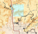
Okay, gimmie a K! by HAZ_Hikebot The primary trailhead meets the K-Hill Trail at a “T” intersection at the end of a short spur. A left-hand turn at the T leads around the western tip of Savage Point before connecting with the Tom’s Canyon Trail. A right-hand turn from the trailhead spur intersection leads east following the foothills of the cliffs that parallel Country Club Drive.
The K-Hill Trail is primarily clay-based. Please refrain from using the trail when it is wet or snow-covered to protect the trail surface. Much of the trail borders private property. Please respect private landowners by staying on the trail and being a good steward. Check out the Official Route and Triplogs. Leave No Trace and +Add a Triplog after your hike to support this local community. One-Way Notice This hike is listed as One-Way. When hiking several trails on a single "hike", log it with a generic name that describes the hike. Then link the trails traveled, check out the example. | ||||||||||||||||||||||||||||||||||||||||||||||||||||||||||||||||||||||
 Route Editor


