Route Editor

| Guide | ♦ | 5 Triplogs | 0 Topics |
details | drive | no permit | forecast | 🔥 route |
stats |
photos | triplogs | topics | location |
| 44 | 5 | 0 |
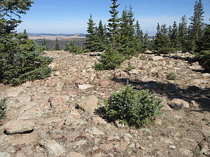
Don't doubt this Thomas by DixieFlyer  Overview OverviewMount Thomas (elevation of 11,121 feet and prominence of 161 feet) is one of 12 named peaks in Arizona with an elevation greater than 11,000 feet. Warning This area often has thunderstorms in the afternoon during the summertime. Thus, it is best to start hiking early and be sure to check weather forecasts on the day of your hike.
Mount Thomas is in the White Mountains of eastern Arizona. Mount Thomas is partly in the Mount Baldy Wilderness and partly in the White Mountain Apache Tribal land; the summit lies in the Mount Baldy Wilderness, just outside the boundary with tribal land. The Mount Thomas summit is about 0.3 miles from East Baldy Trail #95, and the default route in this guide is an out-and-back hike from the East Baldy Trailhead. East Baldy Trail #95 is well maintained and is easy to follow. The trail initially goes alongside the East Fork of the Little Colorado River, and it goes through some lush alpine meadows. After 2.5 miles, you'll come to a hoodoo overlook, which is worth stopping at to enjoy some awesome views. After about 5.5 miles, you'll be just north of the Mount Thomas summit, and a good place to leave the East Baldy Trail is at these coordinates: 33.91515, -109.55332. From here, it about 0.3 miles to the summit. The terrain is good, and the grade is modest, making for a relatively easy off-trail ascent. The summit area is flattish, and it is easy walking to explore the summit. I marked the summit at these coordinates: 33.91313, 109.55216; however, if you wander around on the summit, you might find a spot a foot or so higher. There are some nice views at the summit, especially off to the north. Once you are ready to leave the summit, you have a few options: 1) reverse course and go back to the trailhead (reflected in the stats for this guide) 2) Go back to the East Baldy Trail and continue hiking on the trail to its terminus at the junction with the West Baldy Trail 3) Go off-trail and take a more-or-less direct route to the Mount Baldy summit -- note that legal access to Mount Baldy requires written permission from the White Mountain Apache Tribe(WMAT) A review of triplogs might offer other suggestions. History Mount Thomas is named for U.S. Army General Lorenzo Thomas(1804-1875). Synopsis I don't know that you'd want to make a special trip to the White Mountains to do this hike, but if you are already hiking on the East Baldy Trail, this is a reasonably easy summit to attain. Check out the Official Route and Triplogs. Leave No Trace and +Add a Triplog after your hike to support this local community. | |||||||||||||||||||||||||||||||||||||||||||||||||||||||||||||||||||||||||||||||||||||||||||||||||||