Route Editor

| Guide | 0 Triplogs | 0 Topics |
details | drive | permit | forecast | route |
stats |
photos | triplogs | topics | location |
| 0 | 0 | 0 |
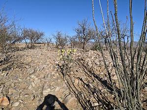
natures rear end by KingLeonidas   Intro IntroFoothills Trail is a connecting trail that runs from Sonoita Creek Trail to Horse Corral Trail in Patagonia Lake State Park. [ map ] Logistics/Getting there The trailhead can be accessed by car by turning left immediately before the Lake Patagonia entrance and Ranger station. There is a parking lot down a short dirt road for accessing several nearby trails. The trailhead is also accessible to boaters/paddlers (which is how we got there) by going ashore on the spillway's left-hand side (boat up campsite 118 is also in the vicinity).
No permit is needed to park in the parking lot. If you are accessing by water, Lake Patagonia day-use permits or camping reservations are required to access the park. Navigation This trail is pretty faint, and it doesn't look like it gets much traffic. There are also several social trails in the area, so it is possible to get off track. Each of the actual trail intersections; i.e., not social trails, were marked with signs. Trail Conditions The surface was mostly packed dirt and larger rocks, nothing very technically challenging. The trail was a bit overgrown in places with thorny vegetation, so we had to duck in a few spots. Weather We did this hike in early April in the afternoon. It was warm but not uncomfortable. General Comments and Musings This trail wasn't too impressive. Unlike the overlook trail that we did earlier on the same day, there wasn't much to see. My impression is that this trail is primarily used by equestrian hikers to access the lake or explore a bit (there was quite a bit of manure on the trail). So unless you are looking to use this trail as an alternative route or short cut between trails or the parking lots, it doesn't have much to offer. There are better hikes nearby that are more interesting to explore.
Check out the Official Route. Leave No Trace and +Add a Triplog after your hike to support this local community. | ||||||||||||||||||||||||||||||||||||||||||||||||||||||||||||||||||||||||||||||||||