username
X
password
register
for free!
help
 This is likely a great time to hike this trail!  Check out "Preferred" months below, keep in mind this is an estimate.
  

Dead Horse Point Rim Trails, UT

Guide 2 Triplogs  0 Topics
  4 of 5  
Fav
Wish
0
details
drive
permit
forecast
route  
stats
photos
triplogs
topics
location
13 2 0
Statistics
tap row or icons for details
Difficulty 1 of 5
Route Finding 1 of 5
Distance Lasso-Loop 9 miles
Trailhead Elevation 5,931 feet
Elevation Gain 300 feet
Accumulated Gain 600 feet
Avg Time One Way 5 hours
Kokopelli Seeds 11
 Backpack No
feature photo
Photos Viewed All MineFollowing
Inaugural Calculation on Button Tap!
19  2022-06-15
Dead Horse Point State Park
markthurman53
13  2021-05-19 trekkin_gecko
Author
author avatar Guides 10
Routes 673
Photos 7,281
Trips 4,660 map ( 39,011 miles )
Age 67 Female Gender
Location phoenix, az
Associated Areas
list map done
Southeast Region
Historical Weather
Trailhead Forecast
Radar Map
Expand Map
Preferred Oct, Apr, May, Sep
Seasons   ALL
Sun  5:52am - 6:43pm
Official Route
 
0 Alternative


Ode to Thelma and Louise
by trekkin_gecko

 Likely In-Season!
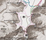
The Dead Horse Rim trails consist of:

Colorado River Overlook Trail
East Rim Trail
West Rim Trail
Bighorn Overlook Trail


You can do a nice hike by starting at the visitor center and going out and back on the Colorado Overlook Trail, then picking up the East Rim Trail down to Dead Horse Point. From there, take the West Rim Trail, then hike out and back on the Bighorn overlook trail. There is a short connector back to the visitor center. If you include all overlooks from the east and west rim, the hike is close to nine miles. You can do shorter combinations too.
remove free decal offer
The overlooks offer tremendous views of the surrounding terrain 2000 feet below. Dead Horse Point at the southern end of the overlooks a Colorado river gooseneck. Potash Ponds and the La Sal mountains are visible to the east.

The trail is on dirt, sand, and slickrock. Footing is usually good. Elevation gain is minimal. There are a few places marked with cairns or black paint. The overlooks are all worth doing, especially Bighorn, which features several deep potholes in the slickrock. There is some exposure, both to sun and near dropoffs.

This is where the ending to the 1991 movie Thelma and Louise was filmed.

2021-05-24 trekkin_gecko
  • DHP SP Trail Map
    guide related
    DHP SP Trail Map


Check out the Official Route and Triplogs.
Leave No Trace and +Add a Triplog after your hike to support this local community.

One-Way Notice
This hike is listed as One-Way.

When hiking several trails on a single "hike", log it with a generic name that describes the hike. Then link the trails traveled, check out the example.
WARNING! Hiking and outdoor related sports can be dangerous. Be responsible and prepare for the trip. Study the area you are entering and plan accordingly. Dress for the current and unexpected weather changes. Take plenty of water. Never go alone. Make an itinerary with your plan(s), route(s), destination(s) and expected return time. Give your itinerary to trusted family and/or friends.

 Permit $$

 Directions
or
 Road
Paved - Car Okay

To hike
The hike begins at the visitor center.
Dead Horse Point State Park is nine miles north of Moab on 191, then 23 miles south on 313.
page created by trekkin_gecko on May 24 2021 2:25 pm
 90+° 8am - 6pm kills
helpcorrectionissue

end of page marker