 Route Editor

| Guide | ♦ | 4 Triplogs | 0 Topics |
details | drive | no permit | forecast | map |
stats |
photos | triplogs | topics | location |
| 34 | 4 | 0 |
choose unsigned supreme flatware junctions wisely by PaleoRob  This area, while close to the City of Pocatello, is in rough country with steep terrain. Use appropriate caution. Overview The 014 trail follows Gibson Jack creek from the sagebrush steppe into the higher elevations around Rock Knoll, eventually crossing meadows and glens before dropping into the Mink Creek drainage.
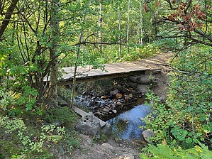
The hike starts at the Gibson Jack trailhead and follows the main trail for about 0.1 miles until coming to a fork. There is a sign on the right-hand trail that discusses non-motorized use of the trail and how this watershed provides drinking water for the city of Pocatello. Take this branch, trail 014, and it will continue to contour along the slope above Gibson Jack Creek. Approximately 0.66 miles from the trailhead, a well-signed trail takes off on the right. The Stirling Justice Trail (505) climbs out of the valley on the right. At the time of this writing, however, the 014 trail is unsigned at this junction and looks like a social trail down to Gibson Jack Creek. Do not be fooled! Take the left fork at the Sterling Justice fork and continue to follow the course of the creek uphill. At approximately 1.7 miles, out of sight of the trail, the north and south forks of Gibson Jack Creek come together to form the main stem of Gibson Jack Creek. Just past this confluence, the trail crosses Gibson Jack Creek on a wooden bridge. This picturesque spot is often the end-point for some hikers and provides a shady rest spot for summer hikes. Past the bridge, the trail begins climbing more seriously, and while the slope the trail is on remains firmly sagebrush steppe, the forest on the north-facing slope across the creek is noticeably becoming more coniferous. At about mile 3.1, the trail crosses the South Fork of Gibson Jack Creek and begins winding its way through meadows among stands of conifers and aspens above 6,300 feet. The trail rapidly rises towards the Gibson Jack/Mink Creek divide at 6,440 feet before dropping into the Elk Meadows basin of Mink Creek and meeting up with the 022 trail. At this point, you car return via the route you took originally or proceed on the 022 to form a loop or shuttle-hike with the many connecting trails in the region. Water Sources Gibson Jack Creek flows year-round and is accessible for most of the hike. It will need to be treated if you are using it as a water source. Camping The Caribou-Targhee National Forest has designated this area as day-use only. Check out the Triplogs. Leave No Trace and +Add a Triplog after your hike to support this local community. One-Way Notice This hike is listed as One-Way. When hiking several trails on a single "hike", log it with a generic name that describes the hike. Then link the trails traveled, check out the example. | |||||||||||||||||||||||||||||||||||||||||||||||||||||||||||||||||||||||||||||


