Route Editor

| Guide | ♦ | 5 Triplogs | 0 Topics |
details | drive | no permit | forecast | 🔥 route |
stats |
photos | triplogs | topics | location |
| 83 | 5 | 0 |
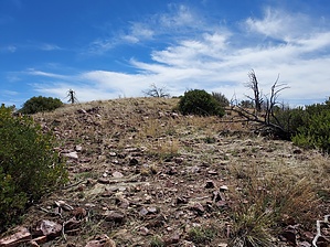
A road less travelled by DixieFlyer   Overview OverviewPeak 7571 is an unnamed peak in the Mazatzal Mountains; its elevation of 7,571 feet is marked on topographic maps, and it has prominence of 1,531 feet. Peak 7571 is right on the Yavapai County-Gila County line, and is 3.5 miles north of Mazatzal Peak. Hike The first 5 miles of the hike is on the Rock Creek Trail #42. As of the date that this guide is written, the Rock Creek Trail is somewhat overgrown and could use some maintenance. It wasn't terrible, but most hikers would want long pants and a long sleeve shirt.
There are no trees and very little vegetation at the summit, and you have great 360-degree views. Enjoy the views and then return the way that you came. Synopsis This is a tough hike over some rough and rocky terrain that is typical of the area. There is great scenery throughout the hike, along with some interesting geology. If you like solitude, you'll likely find it on this hike. Check out the Official Route and Triplogs. Note This is a moderately difficult hike. Leave No Trace and +Add a Triplog after your hike to support this local community. | ||||||||||||||||||||||||||||||||||||||||||||||||||||||||||||||||||||||||||||||||||||||||||||||||||||||||||||