 Route Editor

| Guide | ♦ | 107 Triplogs | 1 Topic |
details | drive | no permit | forecast | 🔥 route |
stats |
photos | triplogs | topic | location |
| 1.5k | 107 | 1 |
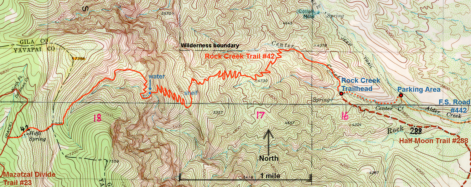
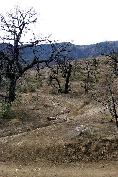
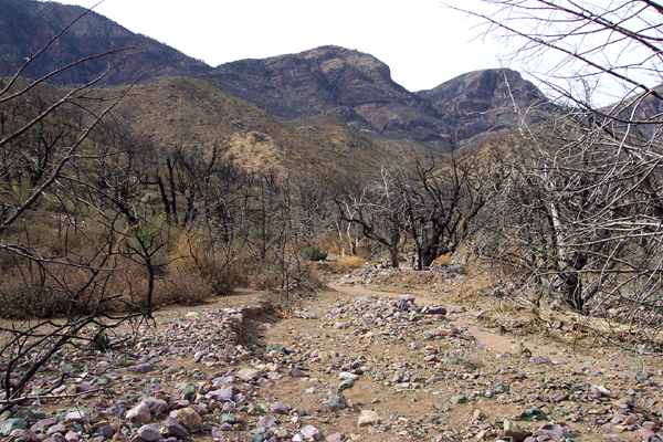
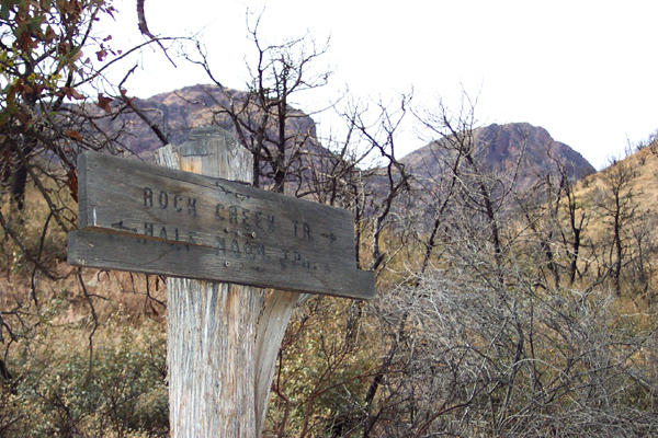
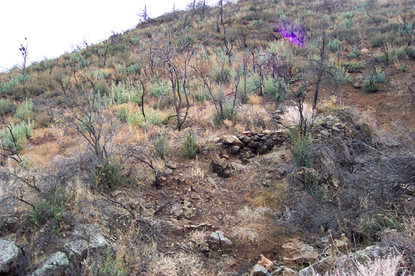
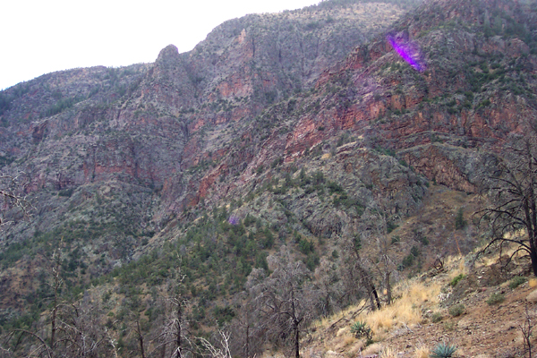
Seldom used old trail by PrestonSands   This old trail dates from at least the 1930s that climbs the nearly vertical eastern face of the Mazatzal Mountains, between Barnhardt Trail and North Peak. It is shown on the Tonto National Forest map but not on the current topo maps. The road to the original trailhead was completely washed away due to erosion following the 2004 Willow Fire, which severely burned most of the Mazatzal Wilderness. While much of the trail passes through the burned area, which is slowly recovering, there are some nice patches of the unburned forest towards the top of the trail. Forest Road #442, which takes you to what I would call the new trailhead, has been nicely rebuilt recently. Please see my topo map. This old trail dates from at least the 1930s that climbs the nearly vertical eastern face of the Mazatzal Mountains, between Barnhardt Trail and North Peak. It is shown on the Tonto National Forest map but not on the current topo maps. The road to the original trailhead was completely washed away due to erosion following the 2004 Willow Fire, which severely burned most of the Mazatzal Wilderness. While much of the trail passes through the burned area, which is slowly recovering, there are some nice patches of the unburned forest towards the top of the trail. Forest Road #442, which takes you to what I would call the new trailhead, has been nicely rebuilt recently. Please see my topo map.Upon turning onto FR442, drive approximately 3 miles to a small parking area on the right side of the road, about one-tenth of a mile past the third creek crossing (this is Center Creek). On the left side of the road at the parking spot, you will see an old road going uphill. This is the beginning of the trail.
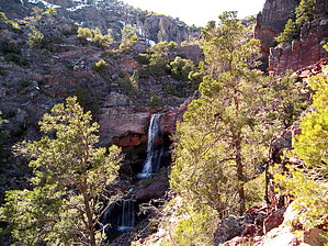
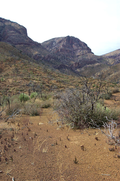
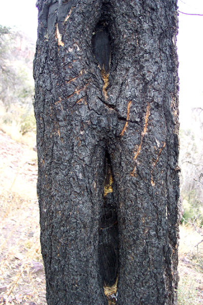
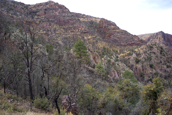
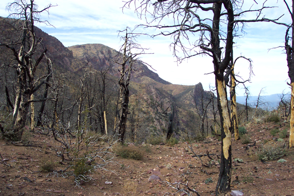
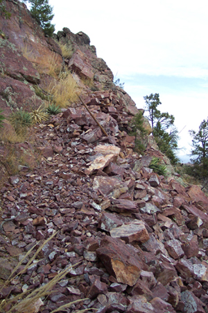
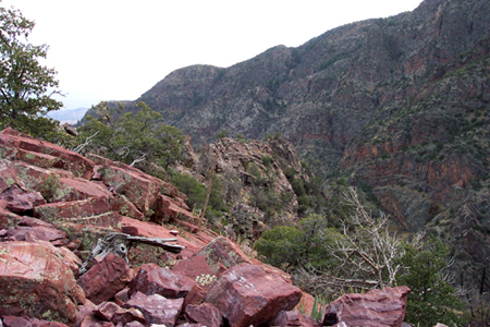
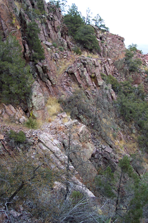
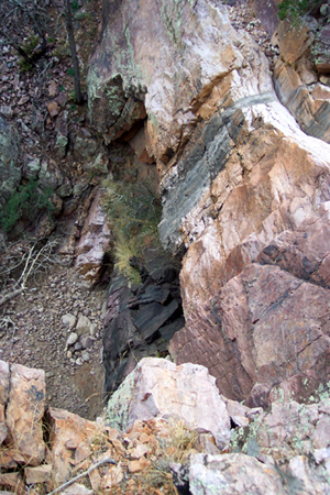
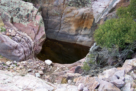
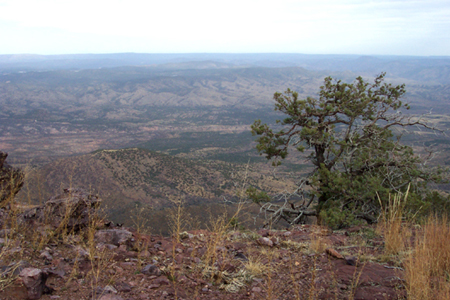
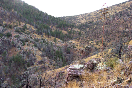
The trail now begins switchbacking up brushy hillsides towards the towering cliffs above. Post-fire erosion and regrowth of oak brush on this stretch make for a rather faint trail. Look for rock cairns. The short rock walls at the points of many of the switchbacks also make good trail markers. The trail makes a steady, never really steep ascent through this mile-long segment. Here and there along the trail, I saw "blaze marks" cut into the blackened trees. This was an old method for marking trails, which consisted of a long vertical notch, topped by a short vertical notch. At the base of the first cliff, I came across the first ponderosa pines (still living). I was now crossing into the Mazatzal Quartzite, a red to purplish rock formation so hard that it tends to form cliffs. The tops of Four Peaks and the northern half of the Mazatzals are made of this rock. Once you reach the top of this little cliff, you will be on a shelf like area on the mountainside. I took a break here, studying the impressive cliffs around me. Now begins a 600-foot climb to the first summit (6200 feet), over a trail that in some spots is held in place on the cliff by rock walls. This was my favorite part of the trail, as it reminded me of the upper stretches of the Grandview Trail in the Grand Canyon. Upon reaching the first summit, I rounded a corner and was in the upper reaches of Rock Creek canyon, with patches of unburned ponderosa and douglas fir forest spread out before me. The trail then crosses a narrow rock ledge, and passes over the top of a seasonal waterfall. Just above the waterfall, I saw a pool of water in a depression in the rock, about 5 feet wide and 4 feet deep. It might have water in it year-round, but it would certainly need to be purified. The trail crosses the creek a second time a little way later and climbs up a ridge to a great overlook of the Payson area and the Sierra Anchas. The trail then steadily climbs as it heads up canyon and reenters the burned area on the way to the 7077-foot pass. Once across the pass, the trail drops about 500 feet in a half-mile, where it meets up with the Mazatzal Divide Trail #23 (part of The Arizona Trail). This is the end of the Rock Creek Trail.
Check out the Official Route and Triplogs. Note This is a more difficult hike. It would be unwise to attempt this without prior experience hiking. Leave No Trace and +Add a Triplog after your hike to support this local community. One-Way Notice This hike is listed as One-Way. When hiking several trails on a single "hike", log it with a generic name that describes the hike. Then link the trails traveled, check out the example. | |||||||||||||||||||||||||||||||||||||||||||||||||||||||||||||||||||||||||||||||||||||||||||||||||||||||||||||||||||||||||||||||||||||||||||||||||||||||||||||||||||||||||||||||||||||||||||||||||||||||||


