username
X
password
register
for free!
help
  This is likely a great time to hike this trail!  Check out "Preferred" months below, keep in mind this is an estimate.
 

Hurd SP - Green Trail, CT

Guide 2 Triplogs  0 Topics
  3 of 5 
Fav
Wish
0
details
drive
no permit
forecast
route  
stats
photos
triplogs
topics
location
0 2 0
Statistics
tap icons for details
Difficulty 0.5 of 5
Route Finding 2 of 5
Distance One Way 1.45 miles
Trailhead Elevation 322 feet
Elevation Gain 115 feet
Accumulated Gain 174 feet
Avg Time One Way 1 hour
Kokopelli Seeds 2.03
 Interest Historic
 Backpack No
feature photo
Photos Viewed All MineFollowing
Inaugural Calculation on Button Tap!
3  2022-08-12
Hurd SP - Yellow Trail
GrangerGuy
15  2022-06-17
Hurd State Park
GrangerGuy
Author
author avatar Guides 26
Routes 101
Photos 688
Trips 78 map ( 891 miles )
Age 66 Male Gender
Location Phoenix, AZ
Associated Areas
list map done
Middlesex Region
Historical Weather
Trailhead Forecast
Radar Map
Expand Map
Preferred Jun, Jul, Sep, Oct → 10 AM
Seasons   ALL
Sun  4:19am - 7:18pm
Official Route
 
2 Alternative
 
 Water


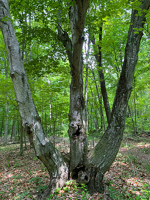
Imagine the Hurd Family Farm
by GrangerGuy

  Likely In-Season!
Overview
Hurd State Park has several hiking trails, imaginatively named Green, Red, Orange, etc. The Green trail follows along part of the eastern park boundary and explores old fields, valleys, and follows an ancient park road.


Hike
The trail starts at the parking lot at the intersection of CT-151 and Hurd Park Road. This lot is open year-round. The path starts at the southeast corner of the lot and is coincident with the White Trail for a short distance until the White Trail bears off to the right. After about 0.2 mi, the Red Trail intersects on the right as well.

From here, the trail climbs gently up its first hill, as it follows along the park boundary. It climbs but does not quite reach the summit of a small, wooded hill, before descending. Be sure to follow the green plastic trail markers on the trees. In this section, some trails may have painted green blazes but are not the official trail anymore.


As the trail descends, it intersects the end of the Blue Trail, and then arrives at the back of a picnic area, with a large lawn, pavilion, and outhouse. A hand-operated water pump is there, but the handle is missing.

The trail immediately exits the lawn, and climbs up a small ravine to a saddle, and then descends to the remnants of an old paved road, where it turns sharply right. It follows the old road to a parking area on the main park road, where it ends, back near the picnic area. If you are making a loop hike with the Red Trail, both come into the picnic area, and this last loop of this paragraph is not needed.

Check out the Official Route and Triplogs.

Leave No Trace and +Add a Triplog after your hike to support this local community.

2022-06-19 GrangerGuy
  • Map
    area related
    Map

One-Way Notice
This hike is listed as One-Way.

When hiking several trails on a single "hike", log it with a generic name that describes the hike. Then link the trails traveled, check out the example.
WARNING! Hiking and outdoor related sports can be dangerous. Be responsible and prepare for the trip. Study the area you are entering and plan accordingly. Dress for the current and unexpected weather changes. Take plenty of water. Never go alone. Make an itinerary with your plan(s), route(s), destination(s) and expected return time. Give your itinerary to trusted family and/or friends.

 Permit $$
None


 Directions
or
or
 Road
Paved - Car Okay

To hike
From Hartford take I-91 South 10 miles to Exit 22S. Follow CT-9 south 5.5 miles to exit 16. Turn right and follow CT-17 0.2 miles up the hill to Main Street / CT-66. Turn right on CT-66 and take it 5 miles east. Turn right onto CT-151 and go south 2.5 miles to a traffic light and the parking lot.
page created by GrangerGuy on Jun 19 2022 5:05 am
 90+° 8am - 6pm kills
helpcorrectionissue

end of page marker