Route Editor

| Guide | ♦ | 10 Triplogs | 0 Topics |
details | drive | permit | forecast | 🔥 route |
stats |
photos | triplogs | topics | location |
| 9 | 10 | 0 |
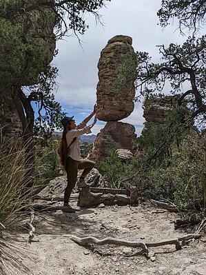
Combination route to see Heart of Rocks and Inspiration Point by KingLeonidas   On our 2nd trip to Chiricahua National Monument we wanted to explore two of the more popular sites; Inspiration Point and Heart of Rocks Loop, in a single-day hike so we came up with this route. On our 2nd trip to Chiricahua National Monument we wanted to explore two of the more popular sites; Inspiration Point and Heart of Rocks Loop, in a single-day hike so we came up with this route.Navigation The route starts from Massai Point and follows the following trails in succession: Massai Point trail to Ed Riggs, Ed Riggs to Mushroom Rock, Mushroom rock to Inspiration Point (and back), Big Balanced Rock to Heart of Rocks, and then the reverse/return after completing Heart of Rocks Loop in a clockwise direction. The result is a long but doable day hike. Navigating this route is pretty straightforward; each of the trail junctions is marked with a sign and the trails are easy to follow. The route was somewhat difficult to discern in portions of the Heart of Rocks loop but there are painted footprints on the rocks in areas where the trail is less obvious. It is possible to do the Heart of Rocks Loop in either the clockwise or counterclockwise direction. We did it clockwise and recommend that approach as many of the named hoodoos will appear in front of you as you go along. Going in the opposite direction you will likely have to stop and look back at the landmarks frequently and may miss some if you don't see all the signs.
well maintained trails throughout for the most part. A few rockier sections exist and the Heart of Rocks Loop has some good steps up on rock rather than dirt trails. There was a tree down over the trail while we were there, but it was not a problem to step over. Fees This is in the Chiricahua National Monument so National Park Service fees normally apply. Both times we were there no one was in the ranger station and it was free to enter. It is not a very crowded park. Weather We went in early April and it was warm but not uncomfortably so, we also had the advantage of a partially cloudy day. Spring and Fall are probably the best times for this hike unless you like the heat. Wind can be significant at higher elevations. General Comments and Musings Inspiration Point and the Heart of Rocks Loop are probably the best locations in Chiricahua National Monument to see the unique hoodoos and geological features of the area (I speak from experience having hiked pretty much all the trails in the Monument over 2 trips). The Heart of Rocks Loop is particularly entertaining as it has many of the "named" hoodoos that the Monument is famous for. The Loop also puts you very close or even in-between to the Hoodoos in a similar fashion to nearby Echo Canyon Trail. Inspiration point was also a worthwhile addition as it gives a good view of Hailstone trail and Sara Deming Canyon. There was also a logbook in an ammo can at Inspiration point. As a route, this combination of trails is moderately difficult. No one section is terribly hard, but the overall mileage and elevation gain does add up. Understandably, mule tours were the historical method for getting to the Heart of Rocks Loop. While we were there we saw a few other groups on the trails but only two were hoofing it to Heart of Rocks. This was a good route and probably the easiest way to see these two sites short of a mule tour. We had a lot of fun doing it. Make sure you bring a camera for funny Hoodoo pictures! Check out the Official Route and Triplogs. Leave No Trace and +Add a Triplog after your hike to support this local community. | |||||||||||||||||||||||||||||||||||||||||||||||||||||||||||||||||||||||||||||||||||||||||||||||||||||||||||||||||||||||||||||||||||||||||||||||||||||||||||||||||||||||||||||||||||||||||||