Overview
This is traditionally listed as an OHV trail but I only saw two during six hours of weekend hiking. An interesting spot where you are more likely to see wildlife than hikers. That was the case for me.
Hike
The directions will take you to a trail that is not even an additional 1/2 mile. You will pass a road that branches off to the right. You will then hit a jct. If you turn right, the trail will then veer left and soon end in a residential neighborhood. If you go left, you can follow it down a ways till it terminates at a dirt road.
There is a second nearby trail that runs parallel to this one. However, private property makes it impossible to connect on either end. Turn near the loud power lines and you will be able to connect.
When hiking several trails on a single "hike", log it with a generic name that describes the hike. Then link the trails traveled, check out the example.
WARNING! Hiking and outdoor related sports can be dangerous. Be responsible and prepare for the trip. Study the area you are entering and plan accordingly. Dress for the current and unexpected weather changes. Take plenty of water. Never go alone. Make an itinerary with your plan(s), route(s), destination(s) and expected return time. Give your itinerary to trusted family and/or friends.
Permit $$
no fees or permits reported
if incorrect tell us about it
Directions
Road
FR / Jeep Road - Car possible when dry
To hike 87 North to 260 E Pass the 260 TH & about 4.5 miles past Rim Road you will come across FR237 to your left. Between mile 1 & 2 turn right on 237B. Don't take the road which veers left. Soon the road turns into a trail. You will see the TH to your right.
page created by ScaredyCat on Jul 18 2022 11:06 pm
 Route Editor

 Overview
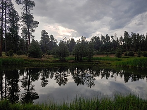


