username
X
password
register
for free!
help
 This is likely a great time to hike this trail!  Check out "Preferred" months below, keep in mind this is an estimate.
 

Warm Springs Trail #147, ID

Guide 0 Triplogs  0 Topics
  0 of 5  
Fav
Wish
0
details
drive
no permit
forecast
route  
stats
photos
triplogs
topics
location
0 0 0
Statistics
tap row or icons for details
Difficulty 2 of 5
Distance One Way 13.91 miles
Trailhead Elevation 6,930 feet
Elevation Gain -2,113 feet
Accumulated Gain 1,119 feet
Kokopelli Seeds 17.64
unreported if dogs are allowed
editedit > ops > dogs to adjust
Post the 1st photoset!
Author
author avatar Guides 16,843
Routes 17,472
Photos 24
Trips 1 map ( 6 miles )
Age 28 Male Gender
Location HAZ, TrailDEX
Historical Weather
Trailhead Forecast
Radar Map
Expand Map
Preferred Jun, Sep, Jul, Aug → 7 AM
Sun  6:07am - 7:12pm
Official Route
 
0 Alternative


undulating terrain
by HAZ_Hikebot

 Likely In-Season!
The Warm Springs Trail is one of the premier trails in the Lowman Ranger District.


The trail is noteworthy as part of the larger loop opportunity for motorcyclists and a one-way trail from Bull Trout to Bonneville for mountain bikers.
remove free decal offer
From the trailhead near Bull Trout Lake Campground, the trail follows undulating terrain through lodgepole pine forests for over 2 miles.

It then descends steeply into Deadman Canyon and crosses Deadman Creek multiple times in the next several miles; this section of the trail is the most difficult to negotiate.

At the bottom of Deadman Canyon, the trail follows Warm Springs Creek through a fairly wide drainage and crosses the creek on a large bridge about halfway down the canyon. This section of trail has both short climbs and descents.

There is a significant climb of just over 2 miles as you leave the canyon bottom which turns into a narrow rocky gorge.

As the trail climbs, it provides nice views of the creek in the gorge below. The trail then intersects with the Link Trail.

Turn left for the final downhill stretch to the trailhead at the Warm Spring Airstrip.

A popular motorcycle loop combines this trail with the Kirkham Ridge and Link Trails. All trails in this loop require advanced motorcycle riding skills.

The preferred mountain bike route is from the northern trailhead to the southern trailhead. Mountain bikers should be prepared for a strenuous ride when attempting this trail.

Although it appears to be mostly downhill, there are plenty of uphill sections that require significant effort.

Additionally, most of the riding is on single track which requires advanced bike handling skills. Hikers will find that the first few miles of trail from either trailhead provide nice out-and-back hiking opportunities.

A 2+ mile hike from the south trailhead provides spectacular views of a narrow gorge at the end of Warm Springs Creek.

2023-07-14 HAZ_Hikebot
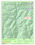
  • North Map
    guide related
    North Map
  • South Map
    guide related
    South Map


Check out the Official Route.
Leave No Trace and +Add a Triplog after your hike to support this local community.

One-Way Notice
This hike is listed as One-Way.

When hiking several trails on a single "hike", log it with a generic name that describes the hike. Then link the trails traveled, check out the example.
WARNING! Hiking and outdoor related sports can be dangerous. Be responsible and prepare for the trip. Study the area you are entering and plan accordingly. Dress for the current and unexpected weather changes. Take plenty of water. Never go alone. Make an itinerary with your plan(s), route(s), destination(s) and expected return time. Give your itinerary to trusted family and/or friends.

 Permit $$
no fees or permits reported

if incorrect tell us about it


 Directions
or
 Road
Paved - Car Okay

To hike
ACCESS #1 - From Boise, Idaho, travel north along State Highway 55 to Banks, Idaho (approximately 38 miles). At Banks, turn right (east) onto State Highway 17 (Banks-Lowman Road) and travel 31 miles to Lowman, Idaho. From Lowman, travel northeast for about 19 miles to a trail sign on the northwest side of the road. Turn southwest at the trail sign and go about two miles passing Warm Springs Guard Station and a landing field.

The unsigned trail begins at the northeast edge of the landing field near a registration box and stock- loading ramp. The road leading to the Guard Station and landing field is normally open only to non-motorized traffic from December 15 to April 15, unless there is a closure in the area.


ACCESS #2- From Boise, Idaho, travel north along State Highway 55 to Banks, Idaho (approximately 38 miles). At Banks, turn right (east) onto State Highway 17 (Banks-Lowman Road) and travel 31 miles to Lowman, Idaho.

From Lowman, travel along State Highway 21 about 34 miles to the intersection of Forest Service (FS) Road 520 (Bull Trout Lake Road). Continue southeast on FS Road 520 about a mile following the signs to Bull Trout Lake Campground. A registration box and the signed trailhead are on the west side of FS Road 520 about a quarter mile north of the campground.


General Notes:
The Warm Springs Trailhead (Airport) is a signed site which includes an information kiosk, loading/unloading ramps for ATVs, hitching rack and registration box. Warm Springs (#147) and Link (#148) trails are served by this trailhead. Located west of Bonneville Campground and next to Warm Springs airstrip.


The Kirkham Ridge Trailhead (State Highway 21) is a signed site with information kiosk. It serves Kirkham Ridge (#144) and Warm Springs (#147) trails. Located near Kirkham Campground.


The Kirkham Ridge Trailhead (Bull Trout) includes a registration box and loading/unloading ramp for animals. It serves Kirkham Ridge (#144), Warm Springs (#147) and Gates Creek (#016) trails.It is located near Warm Springs (Bull Trout) trailhead and Bull Trout Lake Campground.

All trailheads have space for parking.
page created by joebartels on Jul 14 2023 2:05 pm
 90+° 8am - 6pm kills
helpcorrectionissue

end of page marker