Route Editor

| Guide | 0 Triplogs | 1 Topic |
details | drive | no permit | forecast | map |
stats |
photos | triplogs | topic | location |
| 42 | 0 | 1 |
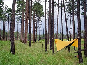
Donkeys in the Mist by pickelltree i started by spending the night at willow creek campground, the campground was filled with fisherman, elk hunters and hikers. there were donkeys wandering around that were used by the hunters to carry out their circus tents. i watched one donkey get loaded to the max because the day before it had kicked someone's horse. it is suggested to get an early start on this hike so you can get over to the west fork to camp before dark. i went about 17 miles to the other side of west fork to camp the first night. there are other options if you don't want to do that many miles. were i camped was a fern-filled field with log-poles standing. i saw about 8 deer in this area and the night was one of the most quiet night i have had camping, no wind, sounds... nothing. the trail to this spot was pretty flat or down hill. the traveling was easy. along the trail at west fork corral i ran to some hunters from Texas. they were great, they offered me a pancake, but i declined because i was already carrying enough food and needed to eat it to lighten my pack. they did ask me if i had seen a hippy guy out there with tattoos. apparently this guy was hiking all the peaks around there in flip flops and only a loin cloth.
on the final stretch the trail is mostly downhill. it goes through a burned area that is patrolled by ravens, it seemed like they escorted me through the area from above. this last 8 miles from hummingbird saddle goes real fast. when i final saw my car at willow creek from above i was pretty excited, it was a nice hike and very satisfying to finish. the trail: go on trail 151 to iron creek. turn down turkey feather pass towards west fork corral. go down to iron creek and follow it down stream to cub mesa, get water and cross creek. start going up hill on trail 152 towards mogollon baldy. another option here would be to go down west fork through the creek for some swimming and meet up with 152 at cub mesa and white creek. trail 152 will take you over mogollon baldy to trail 182, sandy point trail, follow it past west fork saddle to hummingbird saddle where you meet up with trail 172, the white water trail. this takes you back to trail 151 and will connect the loop. willow creek campground is 30 miles back on road 159 from glenwood. the road is curvy and slow. it is paved till mogollon, where there is a town and museum. the rest of the road is dirt, but i drove a low profile car all the way with no problem. water reliable in west fork, white creek and springs, ordinarily springs are at 24.1 miles, 28 miles (west fork saddle) 28.34 (little hobo), and hummingbird saddle. i used the book 50 hikes in new mexico by harry evans for information, trail #43 in the book.
Note This is a moderately difficult hike. Leave No Trace and +Add a Triplog after your hike to support this local community. | |||||||||||||||||||||||||||||||||||||||||||||||||||||||||||||||||||||||||||||||||||||||||||||||||