 Route Editor

| Guide | ♦ | 37 Triplogs | 0 Topics |
details | drive | no permit | forecast | route |
stats |
photos | triplogs | topics | location |
| 361 | 37 | 0 |
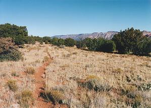
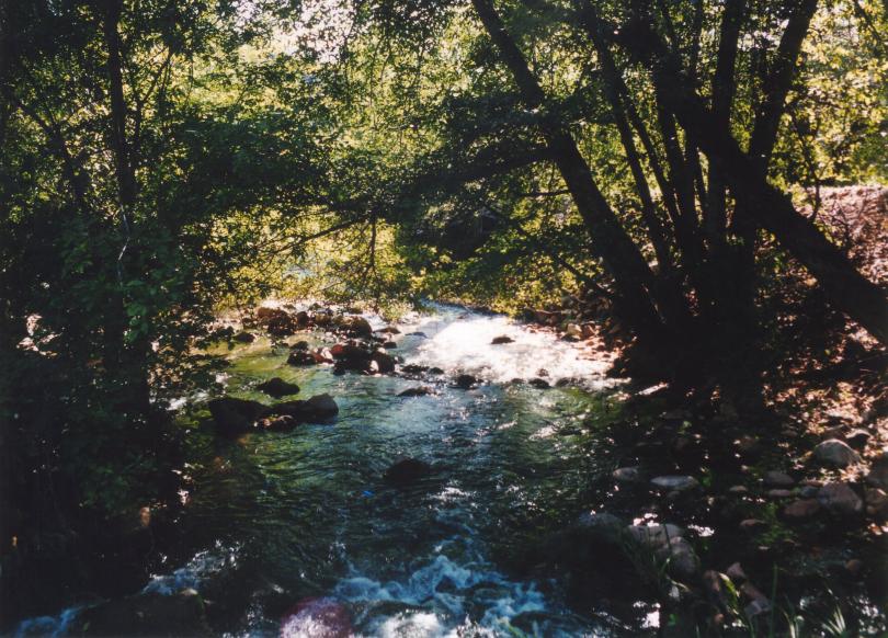
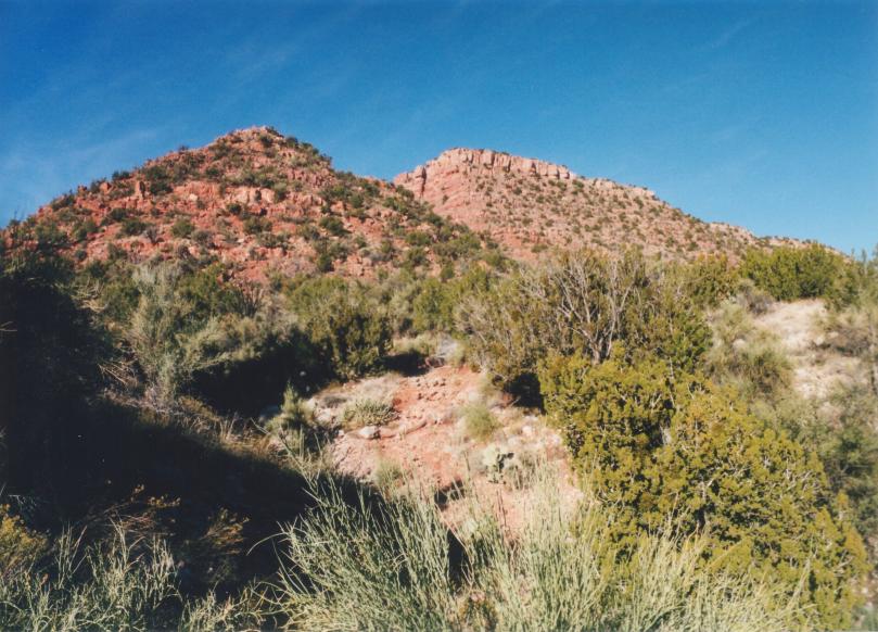
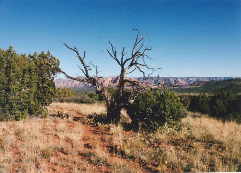
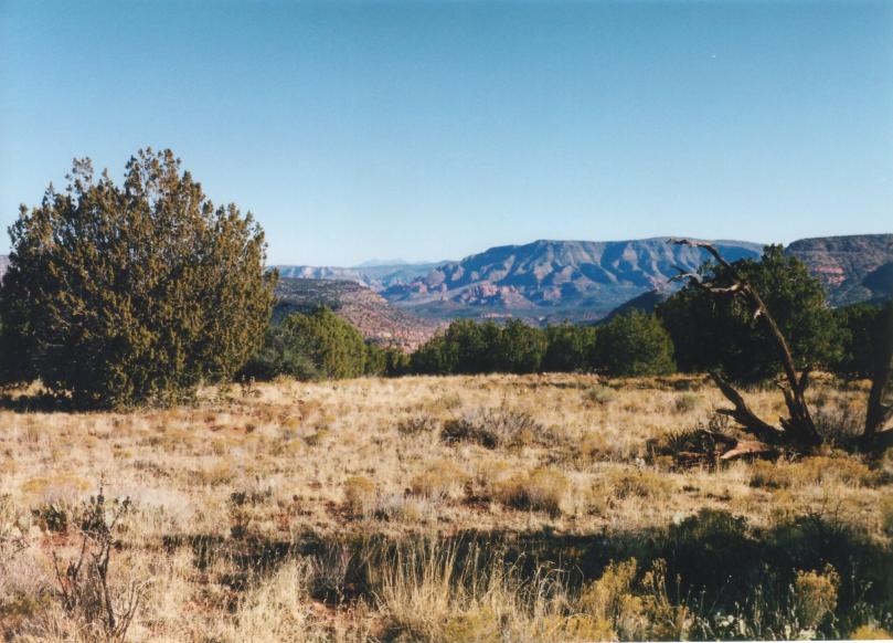
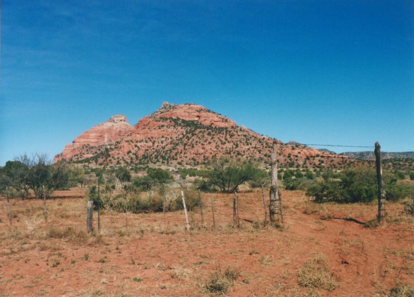
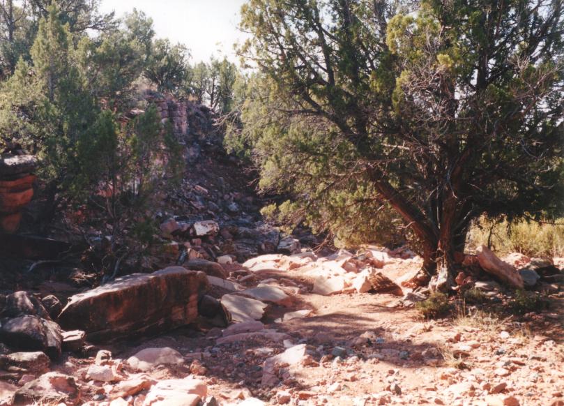
Long walk across the mesa by GTG_AZH  This guide includes the hike to Sycamore Tank and back, plus a description of circling behind the tank and back down into Sycamore Canyon. There is no drinkable water, so bring your own. This guide includes the hike to Sycamore Tank and back, plus a description of circling behind the tank and back down into Sycamore Canyon. There is no drinkable water, so bring your own.This hike starts at the Sycamore Canyon trailhead. Take a left at the trail junction at the bottom of the hill. "The left option crosses the creek and heads up for a long venture over Packard Mesa." Sycamore Canyon calls with its water and beauty, but you have a climb ahead of you, friend. My pictures were taken in late September and late November, thus explaining the different foliage colors and inconsistencies.
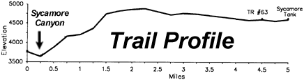
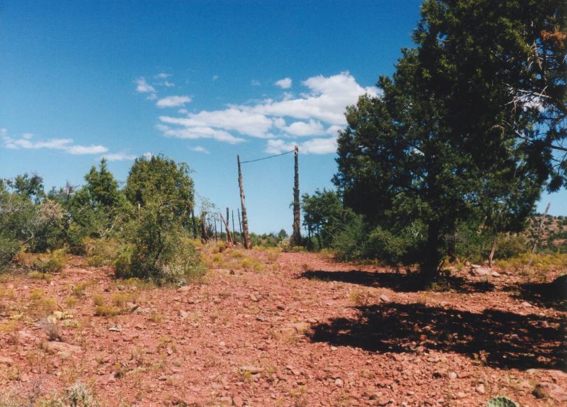
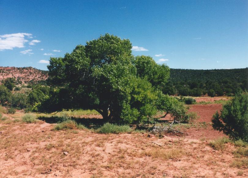
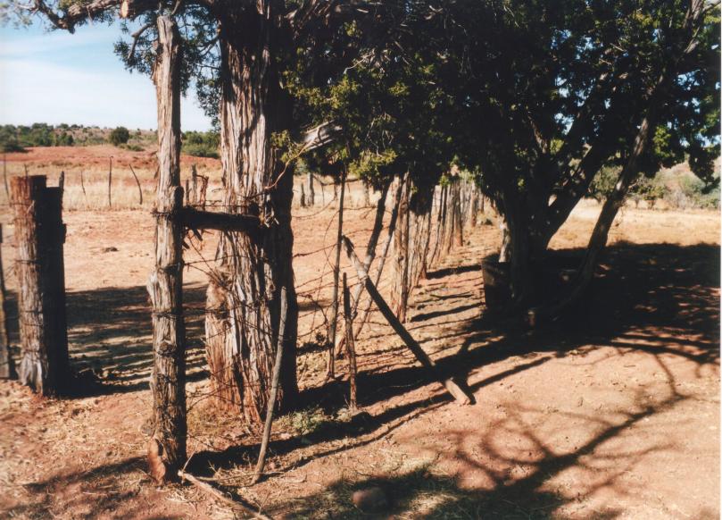
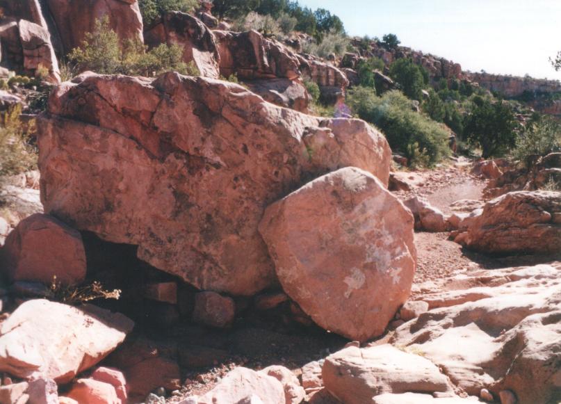
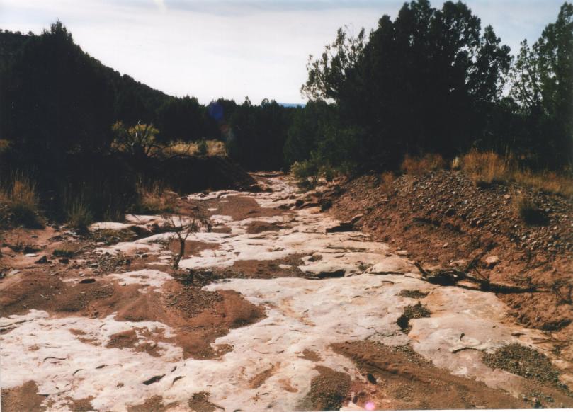
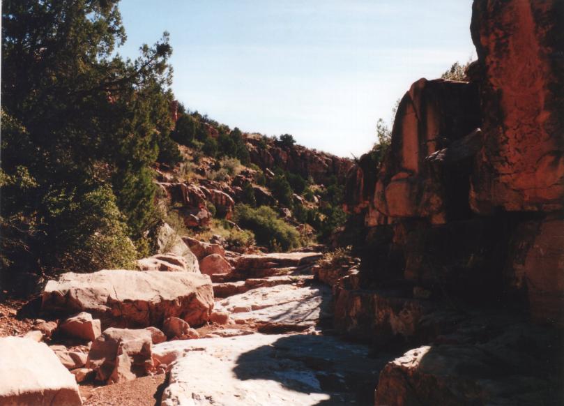
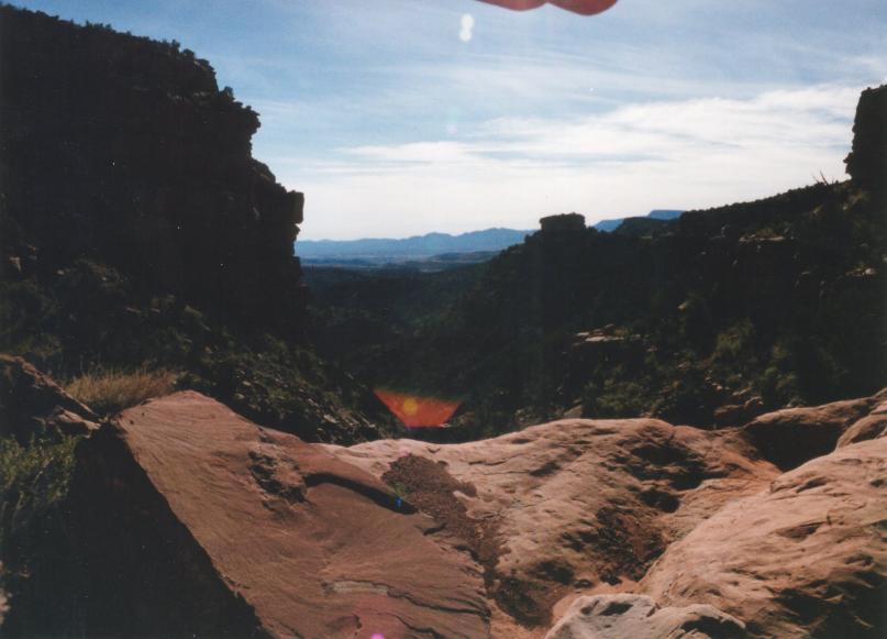
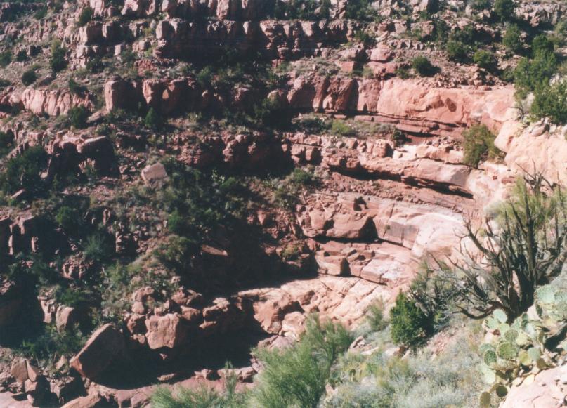
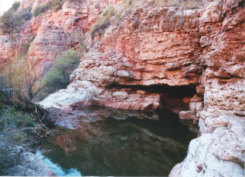
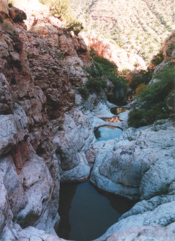
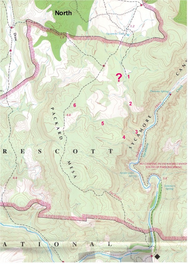
From what I can surmise, Packard Ranch would use this trail to move their cattle up to graze and so forth up on the mesa, letting the cattle roam further north into the higher, cooler ground. The Packard Trail follows a cow path for 3 miles or so across the mesa headed north. The trail meanders back and forth between juniper, pinon pine, and low growing prickly pear. The trail can become confusing as the worn paths are from wandering cows that don't always go the same way. Just keep an eye out for the cowboy sized cairns. I suppose cowboys made these large cairns to be easier to spot in a moving herd. I can only guess that the prickly pear grows so low because of the wind they get up here. If you have time, bring a kite, I guarantee it will fly. This area also seems like it would be frigid in the winter months due to the exposure you get up there. Continue north across the mesa to Sycamore Tank, which is a cow pond. I would not recommend drinking the water here at all due to the cattle fouling it. You will know you're at the tank when you see the gate. When the tank is low, you can take a break under the big cottonwood. It's one of the nicer specimens that I have ever seen. It must do well because of the water and fertilizer it gets. Out the back gate around the east side of the tank is a corral and a couple of metal storage boxes. Sycamore Tank makes a good turn-around spot. Return the way you came in for a 10-mile roundtrip day hike. If you are adventurous and wish to explore the steep canyon going back down into Sycamore Creek, then read on. Warning! This portion of the hike can be dangerous due to the ruggedness of the canyon. This is also a significant drainage from Packard Mesa down into Sycamore Creek. Do not enter the wash or the canyon if you suspect the slightest hint of rain. There are boulders that have been pushed around by some pretty strong water in here. The canyon starts as a gentle wash, quickly becoming a canyon with steep walls. At about a mile from Sycamore Tank down into the canyon, you encounter your first drop-off. It's about a 70-foot high cliff that you must skirt around the edge of down to the bottom. This thing is huge. I took the east side down. Continuing down the canyon, you will encounter many more cliffs like this. Some you can boulder down to the bottom, others I had to go high to the side to make it down. I was solo on this one, so things were a little scary with the cliffs sometimes. You will encounter numerous pools and small caves along the way. Plan your time accordingly. I got to within a few hundred yards of Sycamore Creek and couldn't go any further. All that far and no donut! I could even see Parsons Trail! You may be able to complete the loop I was trying to complete the loop and return via Parsons Trail. I believe the loop is possible, and I will complete it someday. On this day, I couldn't find a way past this set of pools. I underestimated my time and wanted to be out of the canyon by dark, so I had to bushwhack up to the top of the canyon's west side. There is a break in the cliffs at the top, and I got to it and made it out of the canyon in an hour or less. Then I hiked cross-country until I ran across Packard Trail and headed back. From the beginning of the wash to my turnaround point with one small break took 2.25 hours. It took me 45 - 50 minutes to climb out of the canyon through the brush straight up. You can see my reference points on my map. 1. Entered wash into canyon. 2. Encountered first cliffs. 3. Turned around. 4. Exited canyon. 5. Hiked cross-country. 6. Returned on Packard Trail. Gate Policy: If a gate is closed upon arrival, leave it closed after you go through. If it is open, leave it open. Leaving a closed gate open may put cattle in danger. Closing an open gate may cut them off from water. Please be respectful, leave gates as found. The exception is signage on the gate directing you otherwise. Coconino FS Details This trail serves mainly as access to other Sycamore Canyon Wilderness trails. It also provides access to this area from the Cottonwood-Clarkdale area. This is strictly a recreational trail and is used by both hikers and horseback riders. Maps, other resources: Prescott National Forest, east half; U.S.G.S. topographic 7.5' quad for Clarkdale and Sycamore Basin. Trail layout: The trail climbs immediately from Sycamore Creek to Packard Mesa to an elevation of about 4,800 ft. This is the only moderately difficult portion of the trail. The trail then stays on the mesa to where it intersects TR #63. Riders continuing north on TR #63 will find water for horses at Sycamore Tank, just 0.5 miles north of the trail junction. The Sycamore Canyon Wilderness trailhead for TR #63 lies another 0.5 miles north of the tank. Precautions: There is no drinking water along this trail. Check out the Official Route and Triplogs. Leave No Trace and +Add a Triplog after your hike to support this local community. One-Way Notice This hike is listed as One-Way. When hiking several trails on a single "hike", log it with a generic name that describes the hike. Then link the trails traveled, check out the example. | ||||||||||||||||||||||||||||||||||||||||||||||||||||||||||||||||||||||||||||||||||||||||||||||||||||||||||||||||||||||||||||||||||||||||||||||||||||||||||||||||||||||||||||||||||||||||||||||||||||||


