 Route Editor

| Guide | ♦ | 153 Triplogs | 6 Topics |
details | drive | no permit | forecast | 🔥 route |
stats |
photos | triplogs | topics | location |
| 1.8k | 153 | 6 |
Canyons are inherently risky. Flash floods occur without notice on sunny days. Technical skills & surrounding topography knowledge required yet does not eliminate risk.
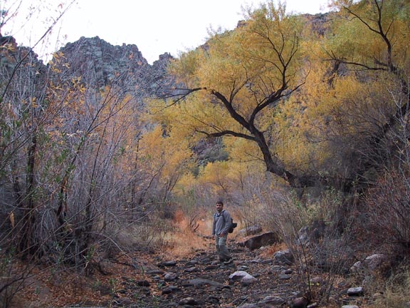
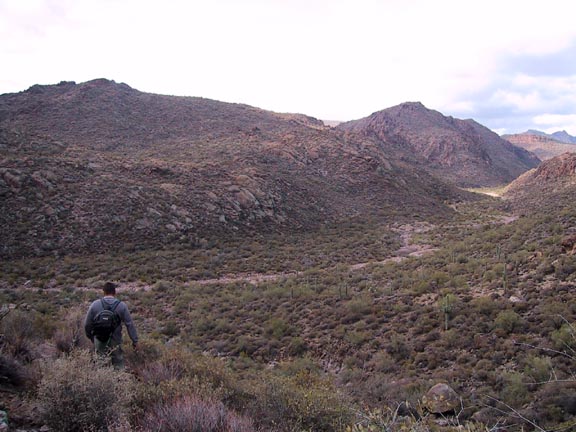
Pure Boulderdash by Fritzski  This hike was done as a 13-mile loop hike beginning at Canyon Lake trailhead and extending through LaBarge Canyon. It starts south on Boulder Creek trail, departs the trail at LaBarge Creek, proceeds through the length of LaBarge Canyon to join with the Cavalry Trail, and loops back on Boulder Creek Tr. to the trailhead. The loop portion basically circumnavigates the base of the magnificent Battleship Mtn. This hike was done as a 13-mile loop hike beginning at Canyon Lake trailhead and extending through LaBarge Canyon. It starts south on Boulder Creek trail, departs the trail at LaBarge Creek, proceeds through the length of LaBarge Canyon to join with the Cavalry Trail, and loops back on Boulder Creek Tr. to the trailhead. The loop portion basically circumnavigates the base of the magnificent Battleship Mtn.For reasons that I'll point out later, probably about 99% of all those who do this hike will not want to complete the difficult entire loop. I will therefore try to describe this hike in two parts. The first, and main part being just that portion that extends upstream to about the halfway point of the canyon, covering the part generally referred to as "lower" LaBarge Box, and back out the same way for about a 9mi total trip.
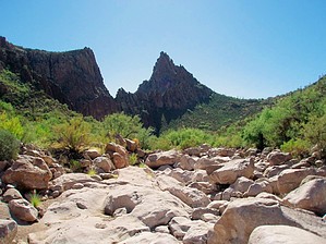
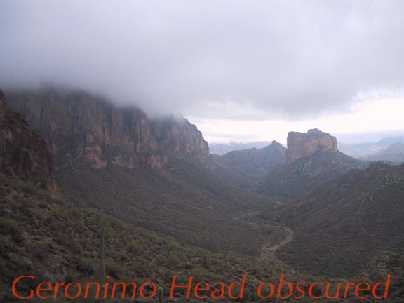
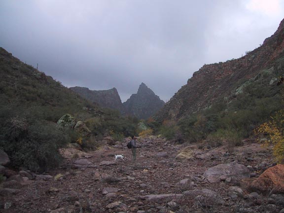
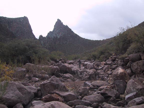
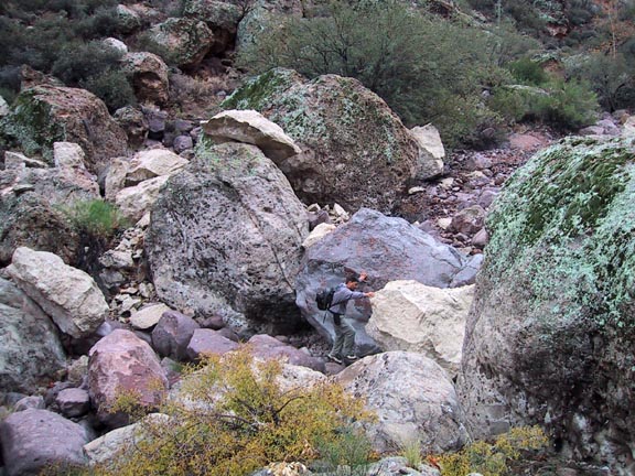
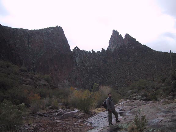
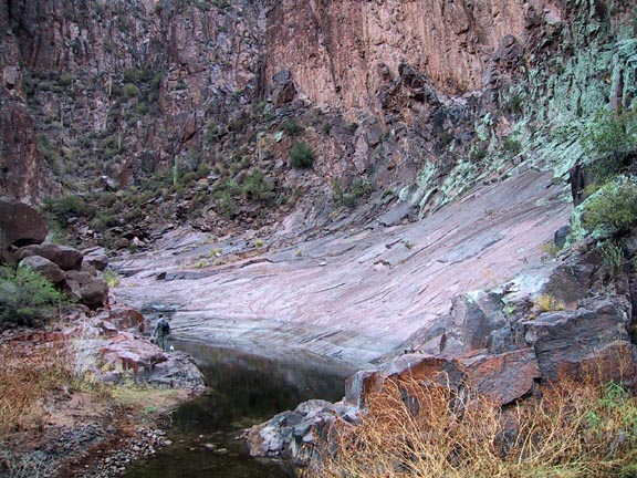
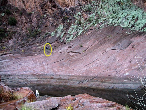
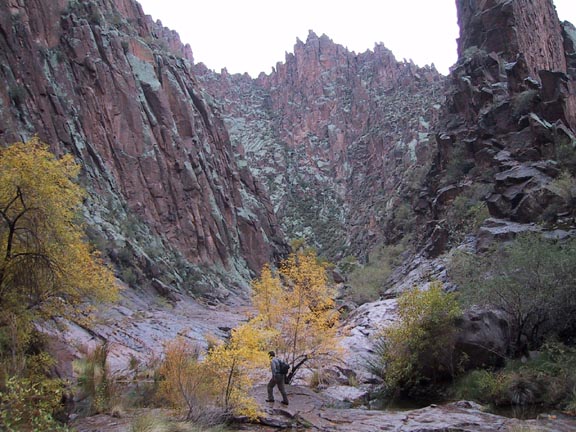
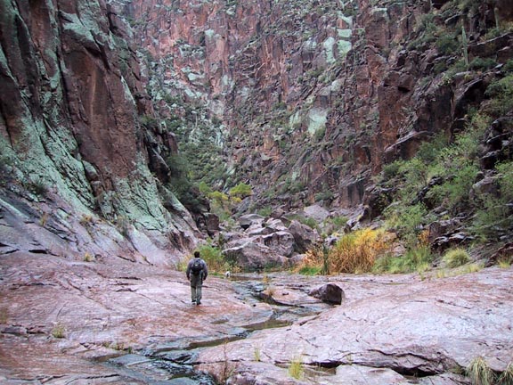
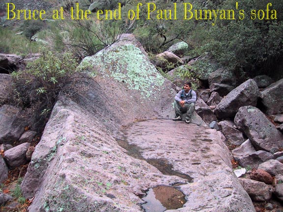
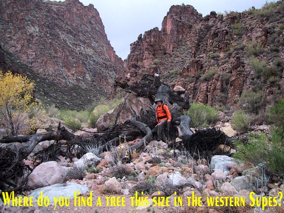
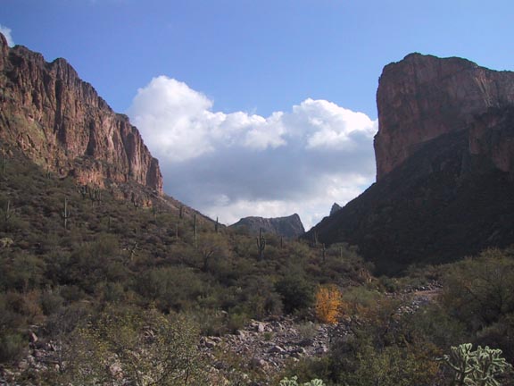
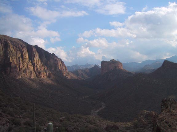
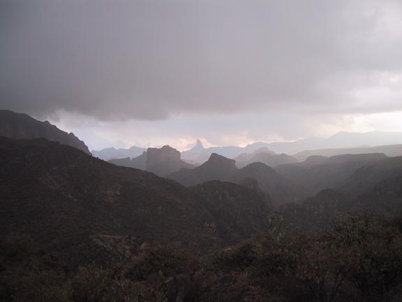
After your descent to the first crossing of LaBarge Creek (@3mi), it is advantageous to stay on the trail for a short distance more. It will parallel the creek on the west side until it finally heads up and to the west over the saddle. It is at this point that you drop into the creek bed and enter the canyon. This will now become your trail to the turnaround point at about the 4.5mi point. Initially the walking is quite easy in the wide-open creek bed varying from some smooth rock areas to "bowling ball" sized rocks and larger. The awesome escarpments of Battleship Mtn. and Geronimo Head rise impressively on either side. Between about 3.5 and 4 miles the terrain begins to transition to areas of giant boulders requiring some moderate scrambling. I suggest that you just use your imagination in finding the best of many possible routes around these obstacles. None present a great problem that even a moderately experienced hiker can't overcome. You will soon begin to notice a jagged wall looming ahead. This is the point at about 4.25mi, shown very distinctly on your topo, where the canyon makes a sharp left bend to be followed by a sharp right. It is here where you will be rewarded by one of the most stunning spots in the Superstitions. After working your way around and through some bus-sized boulders at the bend, the beautiful scene will suddenly unfold as you are able to view around the corner. There is a system of beautiful large pools at the base of an unreal smooth rock slope all under vertical walls that extend straight up for hundreds of feet. There were minnow-sized fish in the pools, which I found surprising. The day we went the rock was quite wet and slippery so care had to be taken with each step. This is a uniquely wonderful spot and the turnaround point for a very nice 9mi in and out hike. If you could catch it on a warm spring day with the water still flowing, it could be quite a fun swimmer's playground. You'll want to spend some time here so plan on a picnic and a rest break before reversing your route back to the parking lot. The continuation of the entire loop hike from this point becomes markedly more difficult, don't go alone. Since the reward vs. effort factor dwindles, I would only recommend it to those hard-core types who are inclined to do it "because it is there". On the other hand, there is quite a high level of satisfaction of "beating" the canyon at its slightly sadistic game of systematically presenting one seemingly impossible boulder obstacle after another. How you choose to attack each problem will vary, so be creative. Some will involve hugging narrow ledges on the side, scrambling straight up boulders, or bushwhacking through a choked opening to name a few. The gloomy and threatening weather on the day we went seemed to add an air of foreboding to the almost suffocating confines of the remote and narrow canyon. A bit of advice would be that you should consider yourself fairly committed after continuing any distance beyond the pools, for it quickly becomes a situation where it is wiser to continue than return through the maze. After you have had enough bouldering, scrambling, and whacking to last you a good while, you will finally emerge from the south end of the canyon and run into the Cavalry Trail. Finally feels like you can breathe again! From here you head right or west on Cavalry Tr. up and over a small saddle where you will get a view of Boulder Canyon and the trail ahead. When you intersect Boulder Canyon Tr. take it north past the Second Water Tr. intersection, Indian Paint mine, and on to the LaBarge Creek crossing where the loop portion will be complete. From here it is a matter of retracing your steps back up and over the hump that so defines the remainder of the Boulder Canyon. Trail. Dry weather may shorten the nine hours hiking time it took us that day. It was our good fortune to get caught in only a mild bout of nearly freezing rain for the last mile. As soon as we got in the car it began a torrential downpour. That gave pause for a sobering thought. See what "living right" will get you! Check out the Official Route and Triplogs. Leave No Trace and +Add a Triplog after your canyon trip to support this local community. | |||||||||||||||||||||||||||||||||||||||||||||||||||||||||||||||||||||||||||||||||||||||||||||||||||||||||||||||||||||||||||||||||||||||||||||||||||||||||||||||||||||||||||||||||||||||||||||||||||||||||||||||||||||||||||||||||


