 Route Editor

| Guide | ♦ | 17 Triplogs | 0 Topics |
details | drive | no permit | forecast | route |
stats |
photos | triplogs | topics | location |
| 5 | 17 | 0 |
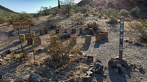
Jack Sparrow Way by mt98dew  Warning WarningThere is some confusion on whether these trails are open to the public. There are signs posted at the Copper State Bike and Hike TH, as well as random locations along the trails stating that this is for residents and their guests only. However, I have reached out to the City of Goodyear and they have said that this is not the case. Overview The Rum Runner Trail is one of 24 trails that make up the Estrella Foothills Trail System. There are currently two THs for this system. The Copper State Bike and Hike and the Estrella Foothills Community Park. This trail is considered an interior trail so some additional hiking is required. The Rum Runner Trail can best be accessed via the Park Ave Trail which starts from the Estrella Foothills Community Park. In addition to being a TH for some of the EF trails, the park also has picnic tables, baseball and soccer fields, a “pump track” (a hilly jump section for bikes), a playground, bathrooms, and a drinking fountain. There is enough parking for 30 cars. The TH is a bit removed from the parking area so one must walk about 0.2 miles to the northeast, circumventing a baseball field. There is an old whiteboard that will help identify the TH. At the TH there will be a carsonite marker with several abbreviations on it. One is the PA (Park Ave) Trail. This is the beginning of the Park Ave Trail which will take you to the Rum Runner Trail.
The Rum Runner Trail is a very short trail, stretching for just under 0.5 miles. It's more of a connector trail. To reach the beginning of the Rum Runner Trail follow the Park Ave Trail for 0.84 miles. The Rum Runner will be signed with a carsonite post with the abbreviation RR (Rum Runner). The trail takes off in a northward direction toward what I consider to be the Estrella Foothills which dominate the view. The trail is a solid single track and will start out climbing a 20-foot hill. The trail will continue to climb along a saddle heading towards the initials “FF” which have been monogrammed into the side of the hill. At 0.35 miles the trail reaches its high point and will swing to the west, round a hill, and then turn back east. Very shortly after that, the Rum Runner will end when it junctures at a nexus with four other trails. This short trail provides a limited look at Sonoran foliage: Creosote, Palo Verde, buckhorn cholla and saguaro pervade the view. Once reaching the end of the trail your options are wide open. You can return the way you came for a 2.6-mile hike. Or, you can continue, on one of the many trails radiating from the nexus. Beware. This trail system is in a finite area but there are many marked and unmarked trails threading together and there is no comprehensive map that shows how they interact. Have a good idea of where you are in conjunction with the TH and how you can get back to it.
Check out the Official Route and Triplogs. Leave No Trace and +Add a Triplog after your hike to support this local community. One-Way Notice This hike is listed as One-Way. When hiking several trails on a single "hike", log it with a generic name that describes the hike. Then link the trails traveled, check out the example. | |||||||||||||||||||||||||||||||||||||||||||||||||||||||||||||||||||||||||||||||||||||||||||||||||||||||||||||||||||||||||||||||||||||||||||||||||||||||||||||||||||||||||||||||||


