username
X
password
register
for free!
help
  

Bean Peaks Gravity Flow Trails, AZ

Guide 2 Triplogs  0 Topics
  4.5 of 5  
Fav
Wish
0
details
drive
permit
forecast
map
stats
photos
triplogs
topics
location
12 2 0
Statistics
tap row or icons for details
Distance Network 20.8 miles
Trailhead Elevation 5,643 feet
unreported if dogs are allowed
editedit > ops > dogs to adjust
feature photo
Photos Viewed All MineFollowing
12  2024-05-22 kingsnake
Author
author avatar Guides 595
Routes 0
Photos 0
Trips 247 map ( 429 miles )
Age ?
Location
Historical Weather
Trailhead Forecast
Expand Map
Preferred Apr, Oct, Nov, Mar → 7 AM
Sun  6:06am - 6:51pm
1 Route
 
0 Alternative


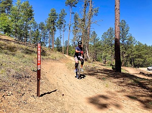
A three phase MTB project by a partnership of Prescott Mountain Bike Alliance, International Mountain Bicycling Association, Prescott National Forest, and others.


Phase 1: 9.2 miles (Spring, 2024)
Phase 2: 6.9 miles (Spring, 2025)
Phase 3: 4.7 miles (Spring, 2026)
remove free decal offer
Phase 3 will include to the summits themselves of Green Bean Peak and West Bean Peak. Not sure how that will affect the Bean Peaks Loop.

Trails are mostly MTB-only (the downhill and freeride segments). Some of the climbs allow two-way pedestrian traffic. Dogs MUST be leashed.

Trail Map


    Check out the Triplogs.
    Leave No Trace and +Add a Triplog after your mountain bike ride to support this local community.
    WARNING! Hiking and outdoor related sports can be dangerous. Be responsible and prepare for the trip. Study the area you are entering and plan accordingly. Dress for the current and unexpected weather changes. Take plenty of water. Never go alone. Make an itinerary with your plan(s), route(s), destination(s) and expected return time. Give your itinerary to trusted family and/or friends.

     Permit $$
    None

    Prescott Forest
    Prescott National Forest Pass

    Only trailheads with six "amenities" have fees. Amenities are picnic tables, trash, toilet, parking, interpretive signing and security.


     Directions
    or
     Road
    Paved - Car Okay

    To mountain bike ride
    From Phoenix, head north on I-17. Take exit 262 west onto AZ-69. Stay on AZ-69 until it turns into Gurley St., in Prescott. Turn left on Montezuma St. / AZ-89, at northwest corner of Courthouse Square. In 2.9 miles, just south of Prescott, turn left into White Spar Campground. The bike trailhead is on the right.
    page created by kingsnake on May 24 2024 5:03 pm
     90+° 8am - 6pm kills
    helpcorrectionissue

    end of page marker