username
X
password
register
for free!
help
  This is likely a great time to hike this trail!  Check out "Preferred" months below, keep in mind this is an estimate.
 

Great Allegheny Passage, MD

Guide 1 Triplog  0 Topics
  4 of 5  
Fav
Wish
0
details
drive
no permit
forecast
route  
stats
photos
triplog
topics
location
0 1 0
Statistics
tap row or icons for details
Distance One Way 150 miles
Trailhead Elevation 616 feet
Elevation Gain 1,750 feet
Accumulated Gain 2,810 feet
Kokopelli Seeds 159.36
feature photo
Photos Viewed All MineFollowing
Will recalculate on button tap!
23  2025-08-08
GAP Trail MP 0.0-15.5
kingsnake
Author
author avatar Guides 595
Routes 0
Photos 0
Trips 247 map ( 429 miles )
Age ?
Location
Historical Weather
Trailhead Forecast
Radar Map
Expand Map
Preferred Jun, Jul, Aug, Sep
Sun  5:47am - 6:40pm
Official Route
 
0 Alternative


  Likely In-Season!
The Great Allegheny Passage, aka the GAP Trail, is a 150-mile rail trail that travels from the end of the C&O Canal in Cumberland, MD, to Point State Park, at Three Rivers in Pittsburgh, PA.


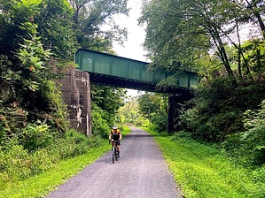
The *only* climb is from 1750 ft. in 22 miles, from Cumberland to Savage Mountain, on the Mason-Dixon Line. (Not quite the Alpe d'Huez ...) From there, it's downhill to Connellsville, PA, and basically level the rest of the way. The opposite direction, the "climb" is 900 ft. in 75 miles -- which hardly counts.
remove free decal offer
Most people bike the GAP Trail in 2-5 days, with ~15 hours total saddle time. Combined with the C&O Canal, it is a ~335 mile ride.


    Check out the Official Route and Triplog.
    Leave No Trace and +Add a Triplog after your hike to support this local community.

    One-Way Notice
    This hike is listed as One-Way.

    When hiking several trails on a single "hike", log it with a generic name that describes the hike. Then link the trails traveled, check out the example.
    WARNING! Hiking and outdoor related sports can be dangerous. Be responsible and prepare for the trip. Study the area you are entering and plan accordingly. Dress for the current and unexpected weather changes. Take plenty of water. Never go alone. Make an itinerary with your plan(s), route(s), destination(s) and expected return time. Give your itinerary to trusted family and/or friends.

     Permit $$
    None


     Directions
    or
     Road
    Paved - Car Okay

    To hike
    From I-68, take exit 43C to Downtown Cumberland. At the bottom of the ramp, turn left on Harrison St. At the next intersection, Canal Place (MP 0.0) is across the street.
    page created by kingsnake on Aug 16 2025 2:31 pm
     90+° 8am - 6pm kills
    helpcorrectionissue

    end of page marker