Route Editor

| Guide | ♦ | 1 Triplog | 0 Topics |
details | drive | permit | forecast | map |
stats |
photos | triplog | topics | location |
| 2 | 1 | 0 |
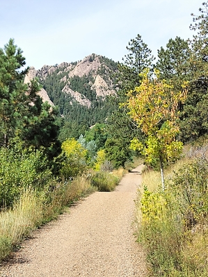
Warm up before step up by ScaredyCat Starts moderate but becomes very steep. Pay attention to RF on way up. Hike Start from Mesa Trail. Soon you'll turn onto Homestead. Further beauty emerges bout an hour in. Bout 1.5 hours in, it becomes significantly steeper. There is a bailout here. A trail emerges that loops you back. Otherwise, game on.
The path does ease up before the summit. The way forward becomes clearer. This is the highest summit in the snowiest city in CO. The route back proved easier to follow. Ideal number of people seen during this hike. I went on a Friday, so it could be crowded on the weekend? Check out the Triplog. Note This is a moderately difficult hike. Leave No Trace and +Add a Triplog after your hike to support this local community. | ||||||||||||||||||||||||||||||||||||||||||||||||||||||||||||||||||||||||||||||||