 Route Editor

| Guide | ♦ | 169 Triplogs | 1 Topic |
details | drive | no permit | forecast | 🔥 route |
stats |
photos | triplogs | topic | location |
| 1.6k | 169 | 1 |
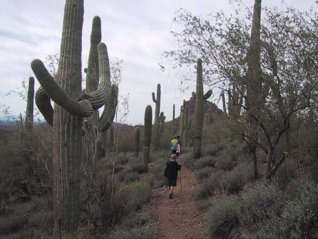
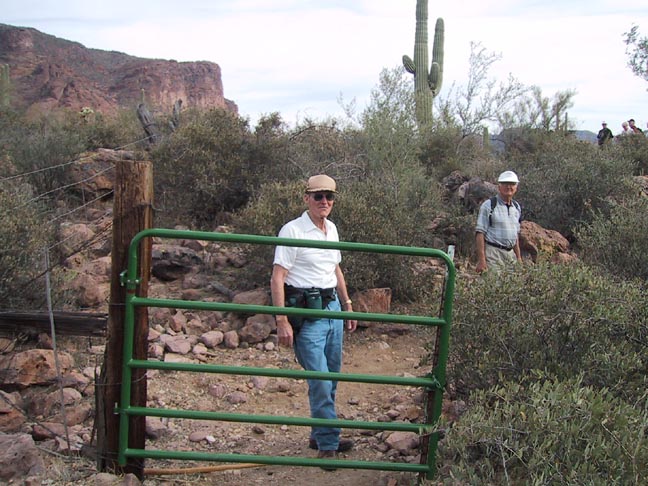
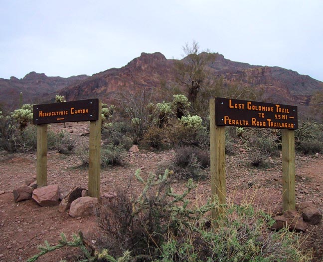
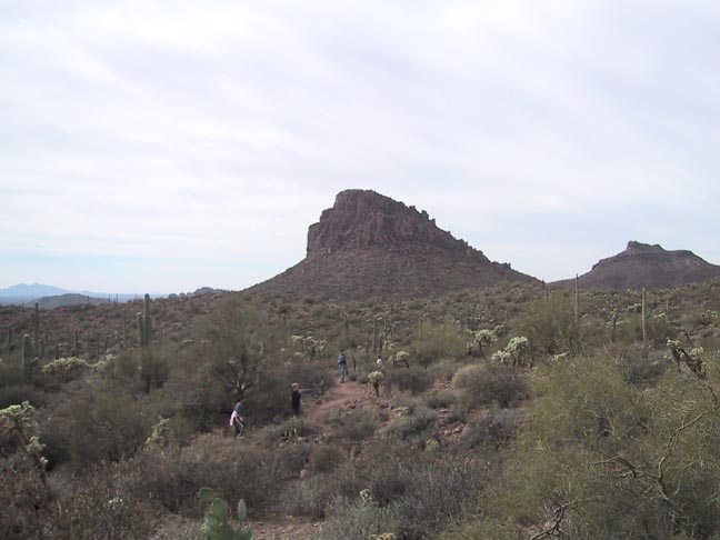
Should be a wildflower bonanza! by Fritzski  This trail connects the Hieroglyph and Lost Goldmine trailheads. Christened the "Lost Goldmine Trail" (see notes #1) in the spring of 2001, it was the result of the hard work of volunteers under the direction of the Superstition Land Trust organization. There is now a seamless connection between the Peralta and Dutchman State Park trailheads with the new Lost Goldmine trail eventually extending westward to meet Jacob's Crosscut trail in the vicinity of the Broadway trailhead. This trail connects the Hieroglyph and Lost Goldmine trailheads. Christened the "Lost Goldmine Trail" (see notes #1) in the spring of 2001, it was the result of the hard work of volunteers under the direction of the Superstition Land Trust organization. There is now a seamless connection between the Peralta and Dutchman State Park trailheads with the new Lost Goldmine trail eventually extending westward to meet Jacob's Crosscut trail in the vicinity of the Broadway trailhead.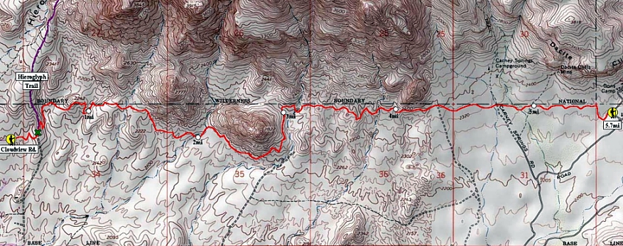 Despite its young age, this pleasant, gentle trail through the Superstition foothills is already quite popular as we saw many other hikers on a weekday afternoon. It is relatively flat and generally follows the contours of the terrain, remaining just outside of the Wilderness Area boundary, which is easily seen by the barbed wire fence. Because of this, the trail is also open to mountain bikes, although I saw none or any tracks on the day I went. Despite its young age, this pleasant, gentle trail through the Superstition foothills is already quite popular as we saw many other hikers on a weekday afternoon. It is relatively flat and generally follows the contours of the terrain, remaining just outside of the Wilderness Area boundary, which is easily seen by the barbed wire fence. Because of this, the trail is also open to mountain bikes, although I saw none or any tracks on the day I went.
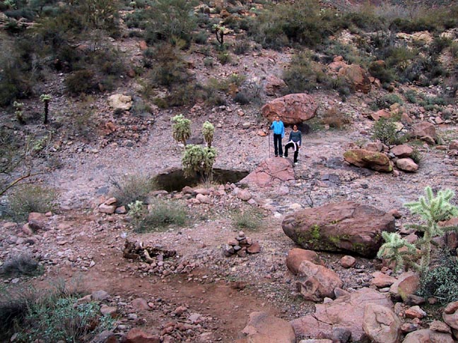
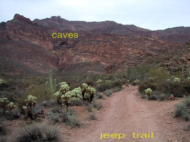
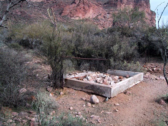
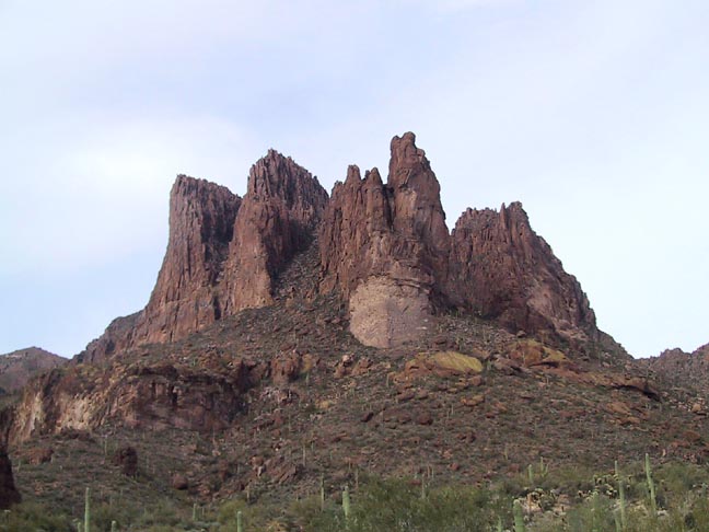
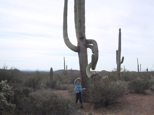
There are brand new trail signs posted at either end of the trail and for my description, we will begin from the Hieroglyph end. From the parking lot at the east end of Cloudview Rd. you head out east on the Hieroglyphic Trail #101 for 0.15-miles till you come to the Lost Goldmine Trail intersection on top of a low ridge. From there you drop off the east side of the ridge and head north until you come to the W.A. boundary where you then start heading east along the south side of the fence. There are two prominent hills ahead of you that will require skirting around the bases to the south. Between the two you will cross a large bare rock drainage that still had spots of water despite the very dry conditions. Shortly thereafter you will come to a surprising jeep trail that appears well used and crosses the trail coming from the south and heads straight into the valley between the hills extending all the way back to the boundary. In this large canyon is a very large and prominent cave/alcove high up on the south face, which can be easily seen from the trail. Continuing, you finish rounding hill "2822" and once again continue to follow the boundary. Along the way you will encounter the remains of an old water retention dam. I am continually amazed by the number of such structures one encounters in the Superstitions that now appear permanently dry. Could this be due to a recent geological change in the area or possibly a change in weather patterns? I don't know the answer but have been informed that the underground water table in the valley is not a factor. A little further on at about the 4.75mi point, you'll cross the Carney Spring trailhead. The views of the ridgeline are quite spectacular here. Finally, you will make a quick dip to the south to cross a gully where you may notice one of the tallest saguaros I have ever seen. Coming right out of the bottom of the gully, it is a single stalk with one low arm and I swear it must be about twice as tall as any saguaro I've ever seen! Unfortunately, I was not able to photograph it, but here's one that's quite expressive! From here you make a quick climb up the other side and to the end of the trail. Which is the former Don's Camp parking lot that is now Lost Goldmine TH. While just a quick walk from the Peralta trailhead, it is outside the W.A. boundary and thus has no parking charges. Although it is my understanding that the Forest Service has some kind of map of this new trail, I'm not aware that it is yet available for human consumption. Therefore I have included a GPS-generated topo map of the trail for those who are interested. Notes: Check out the Official Route and Triplogs. Leave No Trace and +Add a Triplog after your hike to support this local community. One-Way Notice This hike is listed as One-Way. When hiking several trails on a single "hike", log it with a generic name that describes the hike. Then link the trails traveled, check out the example. | |||||||||||||||||||||||||||||||||||||||||||||||||||||||||||||||||||||||||||||||||||||||||||||||||||||||||||||||||||||||||||||||||||||||||||||||||||||||||||||||||||||||||||||||||||||||||||||||


