History: Between 1856 and 1860, several thousand Mormon pioneers made their way to Salt Lake City, hauling their belongings and supplies with handcarts. Iowa City was a major supply point near the beginning of the journey, and many of the pioneers camped along the banks of Clear Creek in this area. Unfortunately, illness and disease took some lives, and at least six pioneers were buried nearby.
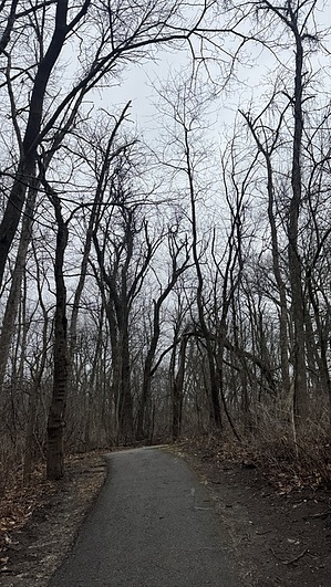
Hike: Starting from the trailhead, the paved trail heads west, with many interpretive signs along the way. The trail stays above the south side of the creek and allows you to look down to where the pioneers camped along the water. The abundance of trees provided firewood and wood for the carts. The area still looks much the same as it did during the late 1850s, when it was a bustling camp for a few years.
Near the west end of the short trail, it connects with the Clear Creek Trail. You can continue west for a longer walk, or turn around and retrace your steps back to the trailhead.
WARNING! Hiking and outdoor related sports can be dangerous. Be responsible and prepare for the trip. Study the area you are entering and plan accordingly. Dress for the current and unexpected weather changes. Take plenty of water. Never go alone. Make an itinerary with your plan(s), route(s), destination(s) and expected return time. Give your itinerary to trusted family and/or friends.
Permit $$
None
Directions
Road
Paved - Car Okay
To hike From I-80 in Iowa City, take 1st Ave south towards the University of Iowa. The road will change names to Mormon Trek Blvd as you head south. Turn right on Hawkeye Park Rd, then right on Hawkeye Ct. The parking area will be ahead on the left. It is open during daylight hours.
 Route Editor